Overview
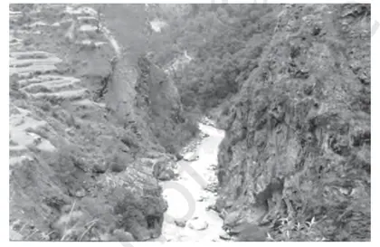
Introduction: This chapter introduces the structure of the Earth and the major physiographic divisions of India. It explains how internal processes (like plate movements, folding, faulting and volcanism) and external processes (like weathering, erosion and deposition) shape the landforms we see today. Importance: Understanding structure and physiography is essential for learning how India’s relief influences climate, drainage, soil, vegetation, natural resources, population distribution and economic activities. It also clarifies why certain regions are prone to hazards such as earthquakes, landslides and floods. Key themes: - Basic structure of the Earth: core, mantle and crust; lithosphere and asthenosphere. - Rock types and the rock cycle (igneous, sedimentary, metamorphic). - Plate tectonics, continental drift and major geologic processes (folding, faulting, volcanism). - Origin and features of India’s major physiographic divisions: The Himalayan Mountains, Northern Plains, Peninsular Plateau (including Central Highlands and Deccan), Indian Desert (Thar), Coastal Plains (eastern and western), and Islands (Andaman & Nicobar, Lakshadweep). - Drainage systems: Himalayan…
Learning Objectives
- Define the concentric layers of the Earth and state the major characteristics of the crust, mantle and core.
- Explain the physical properties of the lithosphere, asthenosphere and their role in Earth's dynamics.
- Describe the three major rock types (igneous, sedimentary, metamorphic) and relate them to geological processes.
- Differentiate between continental and oceanic crust with respect to composition, thickness and age.
- Identify and explain the processes and results of folding, faulting and volcanic activity in shaping landforms.
- Illustrate the formation of principal relief features—mountains, plateaus and plains—and give exam‑oriented examples.
- Analyze the role of plate tectonics, continental drift and sea‑floor spreading in the development of global physiography.
- Interpret topographic maps and cross‑sections to represent relief, contour patterns and landform profiles.
Topics in this chapter
30 topics · tap a topic title to jump straight to it.
Introduction to Structure and Physiography
Structure and physiography deals with the internal constitution of the Earth and the external landforms produced by geological and geomorphic processes. The study links the Earth’s internal structure, tectonic movements and surface processes to explain the origin and distribution of major landforms—mountains, plateaus, plains, coasts and ocean basins.
Earth's internal structure (simple model)
- Crust: Outermost thin, rigid layer (continental and oceanic crust).
- Upper Mantle and Asthenosphere: Partly ductile layer that allows lithospheric plates to move.
- Lower Mantle: More rigid but convecting slowly, transmits heat upward.
- Core: Outer (liquid) and inner (solid) core; source of Earth’s magnetic field and internal heat.
Lithosphere and Plates
- The lithosphere (crust + uppermost rigid mantle) is broken into tectonic plates that move on the asthenosphere driven by mantle convection, slab pull and ridge push.
- Plate interactions at boundaries produce folding, faulting, volcanism, earthquakes and mountain-building (orogeny).
Major processes forming landforms
- Endogenic processes (internal): folding, faulting, volcanic activity, plutonism and uplift. These build relief—mountains, rift valleys, volcanic plateaus.
- Exogenic processes (external): weathering, mass wasting, erosion and deposition by water, wind, ice and gravity. These modify and sculpt the relief into plains, river valleys, deltas and coastal forms.
Principal physiographic units
- Mountains: High relief formed by folding (Himalayas), faulting (Block mountains like the Sierra Nevada) or volcanism (Andes, Cascades).
- Plateaus: Elevated flat regions due to uplift (Tibetan Plateau) or volcanic flood basalt (Deccan Plateau).
- Plains: Low relief areas formed by long-term erosion (peneplains) or deposition (alluvial plains such as the Indo-Gangetic Plain).
- Ocean basins and margins: Continental shelves, slopes, abyssal plains, mid-ocean ridges and trenches (Mid-Atlantic Ridge, Mariana Trench).
Key ideas to remember
- Structure (internal layering) controls heat flow and plate motion; physiography (surface landforms) is the result of both internal and surface processes acting over time.
- Time scale matters: rapid events (earthquakes, eruptions) and slow processes (uplift, erosion) together shape landscapes.
- Isostasy: lithosphere floats on the denser, ductile mantle; erosion and sedimentation cause isostatic adjustments (uplift or subsidence).
This introduction gives the conceptual framework for detailed study of landforms, geological structures and geomorphic processes covered later in the chapter.
- Himalayas: young fold mountains formed by collision of the Indian and Eurasian plates (folding and uplift).
- Deccan Plateau: vast basaltic plateau produced by massive volcanic lava flows (flood basalts).
- Indo-Gangetic Plain: extensive alluvial plain formed by deposition from Himalayan rivers.
- Mid-Atlantic Ridge: submarine ridge formed by divergent plate boundary and seafloor spreading.
- East African Rift Valley: continental rift where faulting and crustal stretching form valleys and volcanic activity.
- Mariana Trench: deep ocean trench formed by subduction of an oceanic plate beneath another plate.
- Density: density = mass / volume (ρ = m / V). Useful when comparing crustal and mantle materials for isostasy considerations.
- Relief: relief = maximum elevation − minimum elevation (in a given area).
- Slope percent: slope (%) = (vertical rise / horizontal run) × 100.
- Slope angle (degrees): slope angle = arctan(rise / run) (useful to convert slope percent to degrees).
- Stream gradient: gradient = vertical drop of stream / length of stream (m/km or m/m).
- Simple rate: rate of uplift or subsidence = vertical displacement / time (e.g., mm/year).
Shape and Size of the Earth
Overview
The Earth is not a perfect sphere. Its actual figure is best described as an oblate spheroid (flattened at the poles and bulging at the equator) and, more precisely, as a geoid when the irregularities of gravity are considered. Understanding the shape and size is essential for navigation, mapping, satellite orbits and geodesy.
Shape
- Oblate spheroid (ellipsoid): Due to Earth's rotation, centrifugal force pushes material outward at the equator causing the equatorial radius (semi-major axis, a) to be larger than the polar radius (semi-minor axis, b). Reference ellipsoids (e.g., WGS84) approximate this smooth shape for mapping and GPS.
- Geoid: The geoid is the equipotential surface of Earth's gravity field that best fits mean sea level globally. It is an irregular surface (mountains and density anomalies cause undulations) and is used as the vertical datum for altitudes.
- Latitudes: Geodetic latitude (used on maps and GPS) is the angle between the normal to the reference ellipsoid and the equatorial plane; geocentric latitude is the angle from Earth's center. They differ slightly due to flattening.
Size — key measured values (standard modern references)
- Equatorial radius (a, WGS84): ≈ 6,378.137 km
- Polar radius (b): ≈ 6,356.752 km
- Mean radius (commonly used): ≈ 6,371 km
- Equatorial circumference: ≈ 40,075 km
- Polar circumference: ≈ 40,008 km
- Surface area: ≈ 510.1 million km² (water ≈ 361 million km², land ≈ 149 million km²)
- Volume: ≈ 1.08321 × 10^12 km³
- Mass: ≈ 5.9722 × 10^24 kg
- Average density: ≈ 5.515 g/cm³
Why Earth is flattened
Rotation produces centrifugal acceleration that is maximum at the equator and zero at the poles. This causes equatorial bulging until gravitational pull and centrifugal force come to equilibrium, producing the oblate spheroid shape. The equatorial–polar radius difference is about 21.385 km (a − b).
How the size was measured — Eratosthenes (classical example)
Eratosthenes (3rd century BCE) used the angles of sunlight at two locations (Syene and Alexandria) and the known distance between them. He observed the Sun was overhead at Syene at noon on the summer solstice but cast a shadow at Alexandria. The angle of the shadow was 7.2° (1/50 of a circle).
Basic idea: if distance between the two places = D and central angle = θ (in degrees), then full circumference C = D × (360/θ). Example numbers: D ≈ 800 km, θ = 7.2° → C ≈ 800 × 50 = 40,000 km. Radius R = C / (2π) ≈ 6,366 km (approximate).
Modern methods
Today we use satellite geodesy (GPS, radar/laser ranging, satellite altimetry and gravimetry) to measure the Earth’s size and shape very precisely and to produce the geoid and standard ellipsoids like WGS84.
Practical consequences
- Gravity varies with latitude and altitude (slightly heavier at the poles than at the equator).
- Map projections must account for Earth’s shape; all projections cause some distortion.
- Navigation and satellite orbits require accurate ellipsoid models (GPS uses WGS84).
- Eratosthenes' measurement: With distance between Syene and Alexandria ≈ 800 km and the Sun's shadow angle 7.2° (1/50 circle) he estimated Earth's circumference ≈ 40,000 km and radius ≈ 6,366 km.
- GPS and WGS84: Modern navigation uses the WGS84 reference ellipsoid (a = 6378.137 km, b ≈ 6356.752 km) so phones and aircraft compute position relative to an agreed mathematical Earth.
- Weight variation: A person weighing 70 kg at the poles will weigh very slightly less at the equator due to weaker effective gravity (centrifugal force and greater distance from Earth's center). The difference is about 0.5% of weight.
- Great-circle flight paths: Airlines use great circles (shortest path on the spheroid) rather than straight lines on maps; e.g., many flights between Europe and North America go near southern Greenland or Iceland.
- Circumference (sphere approximation): C = 2πR
- Surface area (sphere): A = 4πR²
- Volume (sphere): V = (4/3)πR³
- Arc length (central angle θ in radians): s = R × θ
- Flattening of ellipsoid: f = (a − b) / a
- Eccentricity of ellipsoid: e = sqrt(a² − b²) / a
Earth's Interior — Layers
Overview
The Earth is layered both chemically and physically. Chemically there are three concentric shells: the crust, the mantle and the core. Physically the Earth is divided into the lithosphere, asthenosphere, mesosphere (lower mantle), outer core and inner core. These layers differ in composition, temperature, density and mechanical behaviour.
Chemical layers
- Crust: Outermost thin shell. Two types — continental crust (granitic, ~35–70 km thick, density ~2.7 g/cm³) and oceanic crust (basaltic, ~5–10 km thick, density ~3.0 g/cm³). The crust–mantle boundary is the Mohorovičić discontinuity (Moho).
- Mantle: Extends from the Moho to about 2891 km depth (~2900 km thick). Composed mainly of silicate minerals rich in Mg and Fe. Upper mantle (to ~410–660 km) and lower mantle (to CMB). Average mantle density increases with depth (~3.3 → 5.7 g/cm³).
- Core: Central region composed largely of iron and nickel. Divided into a liquid outer core (from ~2891 km to ~5150 km depth) and a solid inner core (from ~5150 km to Earth's centre at ~6371 km). Densities: outer core ~9.9–12.2 g/cm³, inner core ~12.8–13.1 g/cm³.
Physical layers
- Lithosphere: Rigid outer shell including crust + uppermost solid mantle. Thickness varies (a few km under oceans to ~200 km under old continents). It is broken into tectonic plates.
- Asthenosphere: Mechanically weak, partially ductile zone below the lithosphere (roughly 100–200 km depth in many regions) that allows plate motion; shows low seismic velocities.
- Mesosphere (lower mantle): More rigid because of higher pressure though still capable of slow flow; extends down to the core–mantle boundary (CMB).
- Outer core: Liquid, convecting iron–nickel alloy; its motion generates Earth's magnetic field (geodynamo).
- Inner core: Solid, extremely hot and under immense pressure.
Key observations and evidence
- Seismic waves: Primary (P) waves travel through solids and liquids; Secondary (S) waves travel only through solids. The disappearance of S waves and changes in P-wave velocities at ~2891 km depth indicate a liquid outer core (Gutenberg discontinuity). The inner core boundary (Lehmann discontinuity) is inferred from P-wave reflections and arrivals that indicate a solid inner core.
- Density & gravity data: Earth's mean density (~5.52 g/cm³) is much greater than surface rocks, implying dense materials (iron) at depth.
- Heat flow & volcanism: Mantle melting produces magma that fuels volcanoes and mid-ocean ridges, showing mantle dynamics.
- Meteorites: Composition of iron meteorites helps infer core composition.
Temperature and pressure
- Temperature and pressure increase with depth (geothermal gradient in the crust typically ~25–30 °C/km; deeper parts of mantle and core reach thousands of °C).
- Pressure rises roughly with depth following hydrostatic principles (pressures reach gigapascals at mantle depths and hundreds of gigapascals at the centre).
Dynamic processes
- Convection in the mantle drives plate tectonics: hot mantle material rises at divergent boundaries (mid-ocean ridges) and cools and sinks at subduction zones, creating mountains, earthquakes and volcanic activity.
- Outer core convection coupled with Earth's rotation sustains the geomagnetic field.
Important discontinuities (approx. depths)
- Mohorovičić (Moho): crust–mantle boundary (few km under oceans up to ~70 km under some continents).
- 410 km and 660 km discontinuities: phase-change boundaries in the upper mantle.
- Gutenberg discontinuity (CMB): ~2891 km depth (mantle–outer core boundary).
- Lehmann discontinuity (inner core boundary): ~5150 km depth (outer core–inner core).
Summary
The layered structure of Earth — revealed chiefly by seismology, gravity and heat-flow studies — explains why the planet behaves as it does: rigid lithospheric plates move on a ductile asthenosphere, deep mantle convection drives surface geology, and a metallic convecting outer core produces the magnetic field.
- Volcanic eruptions at mid-ocean ridges: partial melting of upwelling mantle produces basaltic oceanic crust.
- Earthquake S-wave shadow zone: absence of S waves on the opposite side of Earth demonstrates a liquid outer core.
- Mountain building (Himalayas): collision of continental lithospheric plates driven by mantle convection and plate motions.
- Magnetic field observations: secular variation and polarity reversals are explained by fluid motion in the outer core (geodynamo).
- Isostasy example: continental crust floats higher on the mantle than oceanic crust—explains higher elevation of continents.
- Meteorite composition: iron meteorites provide analogues for Earth's core composition (Fe–Ni).
- Hydrostatic pressure (approx.): P = ρ g h (P in Pa, ρ in kg·m⁻³, g ≈ 9.8 m·s⁻², h depth in m). Example: at 100 km with ρ ≈ 4000 kg·m⁻³, P ≈ 3.9 × 10⁹ Pa (≈3.9 GPa).
- Average density of a sphere: ρ_avg = M / (4/3 π R³). (Earth's mean density ≈ 5.52 g·cm⁻³.)
- Seismic wave speeds (elastic theory): P-wave speed v_P = sqrt((K + 4/3 μ) / ρ), S-wave speed v_S = sqrt(μ / ρ), where K is bulk modulus, μ is shear modulus and ρ is density. S waves require non-zero μ (i.e., a solid).
- Geothermal gradient (approx. in crust): ΔT/Δz ≈ 25–30 °C·km⁻¹ (varies by region).
Discontinuities
Definition: Discontinuities are boundaries inside the Earth where physical properties (composition, density, seismic-wave velocity or state) change abruptly. They are identified from the behaviour of seismic waves (reflection, refraction, velocity jumps, shadow zones) and mark major changes in Earth's internal structure.
Main discontinuities and their characteristics:
- Conrad discontinuity (continental crust internal boundary): typically at ~15–20 km depth in many continental regions; separates the upper (felsic/granite) crust from the lower (more mafic) crust. Not globally present.
- Mohorovičić (Moho) discontinuity: marks the crust–mantle boundary. Depth: about 5–10 km beneath ocean floors and ~30–50 km (locally up to ~70 km beneath mountain belts) beneath continents. Identified by a sudden increase in P- and S-wave velocities.
- 410 km and 660 (≈670) km discontinuities (mantle transition zone): caused by mineral phase changes (e.g., olivine → wadsleyite → ringwoodite → perovskite + ferropericlase). These control mantle convection and material exchange between upper and lower mantle.
- Gutenberg discontinuity (core–mantle boundary): at about 2,890 km depth. Marked by a large drop in S-wave activity (S-waves vanish because the outer core is liquid) and strong refraction of P-waves.
- Lehmann discontinuity / Inner-core boundary: at about 5,150 km depth (radius ~1,221 km). Separates the liquid outer core from the solid inner core; P-wave behaviour and small velocity increase indicate solidity of the inner core.
Causes of discontinuities: abrupt changes in mineral composition or chemical makeup, phase changes induced by pressure/temperature, and change of physical state (solid ↔ liquid). These cause sudden changes in density and elastic properties, producing seismic velocity jumps or disappearances (S-wave shadowing).
Seismic evidence & importance: Seismologists use travel-time curves, arrival patterns and shadow zones from earthquakes to detect these boundaries. For example, the S-wave shadow zone (caused by the liquid outer core) and P-wave refraction patterns were key to discovering the core and measuring Moho depth. These discontinuities explain how heat, material and seismic energy move inside Earth and are fundamental to understanding tectonics, volcanism and mountain-building.
Summary: Discontinuities are internal boundaries of abrupt change (composition, state or mineral structure) in the Earth. Their identification via seismic waves provides the main direct evidence for layered internal structure: crust, mantle (with transition zone), outer core (liquid) and inner core (solid).
- Mohorovičić discovered the Moho in 1909 from the sudden increase in seismic velocities below the crust; oceanic crust Moho is shallow (≈5–10 km) while continental Moho is deeper (≈30–50 km).
- The Gutenberg discontinuity (≈2,890 km) explains the S-wave shadow zone: S-waves from earthquakes do not arrive on the Earth’s surface opposite the source because S-waves cannot travel through the liquid outer core.
- 410 km and 660–670 km discontinuities are responsible for trapping some mantle convection and for causing phase-change related seismic velocity jumps used to map subducting slabs and mantle plumes.
- Conrad discontinuity is observed beneath many continental regions as a seismic velocity change within the crust separating upper felsic and lower mafic crustal layers.
- Snell's law for seismic waves: sin θ1 / v1 = sin θ2 / v2 (θ = angle to normal, v = seismic velocity in each layer).
- Critical-refraction condition: for a refracting interface, sin i_c = v1 / v2 (v1 < v2), where i_c is the critical angle producing head waves.
- Travel-time of a critically refracted (head) wave in a two-layer model: t = (2h cos i_c)/v1 + x/v2, where h = layer thickness, x = horizontal distance on surface, v1 = velocity of upper layer, v2 = velocity of lower layer.
- Seismic velocities from elastic moduli: P-wave velocity vp = sqrt((K + 4/3 μ) / ρ); S-wave velocity vs = sqrt(μ / ρ), where K = bulk modulus, μ = shear modulus, ρ = density.
Lithosphere and Asthenosphere
Definition and composition
The lithosphere is the rigid outer shell of the Earth that includes the crust and the uppermost part of the mantle. It behaves elastically and brittlely and is broken into tectonic plates. The asthenosphere lies immediately beneath the lithosphere and is a part of the upper mantle that is mechanically weak, ductile and partially molten; it can flow slowly.
Thickness and typical values
• Continental lithosphere: broadly 50–250 km (often about 100–200 km).
• Oceanic lithosphere: thinner, commonly 5–100 km depending on age.
• Asthenosphere: begins beneath the lithosphere (commonly around 50–200 km depth) and extends down to a few hundred kilometres; a commonly used active layer is roughly 100–700 km although its mechanically important, low-viscosity part is mostly in the upper ~100–300 km.
Physical differences
• Mechanical behavior: lithosphere is strong and brittle; asthenosphere is ductile and convects slowly.
• Temperature: lithosphere is cooler; asthenosphere reaches higher temperatures (near the melting point of mantle rocks), which produces partial melt and a low-velocity seismic zone.
• Seismic properties: the asthenosphere corresponds to a seismic low-velocity zone (LVZ) because of partial melt and reduced rigidity.
Role in plate tectonics
The lithosphere forms rigid plates that move over the asthenosphere. Movement is driven by mantle convection, slab pull and ridge push. The ductile asthenosphere acts as a mechanical buffer and allows plates to translate, rotate and interact (diverge at mid-ocean ridges, converge at subduction zones, transform at faults).
Isostasy and interaction
The concept of isostasy describes how lithospheric blocks float in gravitational balance on the denser, deformable asthenosphere. Thickened lithosphere (mountain roots) sinks deeper into the mantle; erosion causes uplift (isostatic rebound). The asthenosphere provides the buoyant supporting medium.
Importance
Understanding the lithosphere and asthenosphere explains earthquakes (occur mostly in lithosphere), volcanism (melt generation involving asthenospheric upwelling), mountain building, continental drift and sea-floor spreading.
- Mid-ocean ridges: Upwelling asthenosphere produces magma that forms new oceanic lithosphere (example: Mid-Atlantic Ridge).
- Subduction zones: Older, denser oceanic lithosphere sinks into the mantle at trenches (example: Mariana Trench), interacting with and deforming the asthenosphere.
- Hotspots and mantle plumes: Hawaii is a result of a deep mantle plume and asthenospheric melting producing volcanic islands while the Pacific lithosphere moves above it.
- Isostatic rebound: Scandinavia and parts of Canada are still rising after ice-sheet melting because the lithosphere is rebounding on the asthenosphere.
- Earthquake distribution: Shallow earthquakes occur within the brittle lithosphere (e.g., Himalayan seismicity in the Indian plate's lithosphere).
- Lithostatic pressure (approximate): P = ρ g h where P is pressure, ρ is average density of overlying rock, g is gravitational acceleration (≈9.81 m/s2), and h is depth.
- Geothermal gradient: G = ΔT / Δz where ΔT is temperature change over depth Δz (°C/km). Typical upper-mantle gradients are a few °C/km but vary strongly with tectonic setting.
- Heat flux (Fourier's law): q = -k dT/dz where q is heat flow, k is thermal conductivity, and dT/dz is temperature gradient.
- Archimedes' principle applied to isostasy (simple form): ρ_c * h = ρ_m * d where ρ_c is crustal density, h is topographic height (or crustal thickness above compensation level), ρ_m is mantle density and d is depth of the compensating root. (This is a simplified mass-balance expression for Airy-type isostasy.)
Rocks and the Rock Cycle
Definition: Rocks are naturally occurring aggregates of one or more minerals. The rock cycle is the continuous set of processes by which rocks are formed, altered, destroyed and reformed by geological processes operating at Earths surface and in its interior.
Main rock types:
- Igneous – formed by solidification of molten magma or lava. Two textural types: intrusive (plutonic, slow cooling, coarse-grained e.g., granite) and extrusive (volcanic, rapid cooling, fine-grained e.g., basalt).
- Sedimentary – formed by deposition, burial and lithification of sediments. Categories: clastic (sandstone, shale), chemical (limestone, evaporites), organic (coal). Sedimentary rocks commonly contain fossils and layering (strata).
- Metamorphic – formed when existing rocks are changed by heat, pressure and chemically active fluids without melting. Foliated (gneiss, schist) and non-foliated (marble, quartzite).
The rock cycle — principal processes:
- Melting: Rocks melt in the mantle or deep crust to form magma.
- Crystallization: Magma cools to form igneous rocks.
- Weathering and erosion: Physical and chemical breakdown of rocks at the surface; agents include water, wind, ice, temperature changes and biological activity.
- Transport and deposition: Sediments are moved and deposited in basins (rivers, deltas, oceans, deserts).
- Lithification: Compaction and cementation turn sediments into sedimentary rocks.
- Metamorphism: Burial, tectonic stresses and heat alter rocks into metamorphic rocks.
- Uplift and exposure: Tectonic processes bring deep rocks to the surface, exposing them to weathering and restarting the cycle.
Important classification and quantitative notes:
- Igneous silica (SiO2) classification roughly: felsic > 65% (granite), intermediate 52–65% (andesite), mafic 45–52% (basalt), ultramafic < 45% (peridotite).
- Sediment grain-size classes (approx.): clay <0.002 mm, silt 0.002–0.063 mm, sand 0.063–2 mm, gravel >2 mm.
- Metamorphism depends on pressure-temperature (P-T) conditions; low-grade to high-grade metamorphism produces progressively different minerals and textures.
Significance: Rocks determine landforms, soil types and natural resources (building stone, ores, coal, petroleum, groundwater aquifers). Understanding the rock cycle explains landscape evolution and resource distribution.
Examples from India: Deccan Traps (extensive basaltic igneous flows), Vindhyan and Gondwana sequences (sedimentary rocks like sandstones, coal measures), Aravalli and Peninsular Shield (ancient metamorphic and igneous rocks), Himalayan metamorphic belts (schists and gneisses).
Study tip: Use a simple diagram with three boxes (Igneous, Sedimentary, Metamorphic) and arrows indicating the processes between them (melting, cooling, weathering, lithification, metamorphism, uplift) to visualise the cycle.
- Granite (igneous, intrusive) used as dimension stone in buildings and monuments
- Basalt (igneous, extrusive) forming the Deccan Traps and used in road aggregates
- Sandstone (clastic sedimentary) forming cliffs and aquifers, e.g., parts of the Vindhyan basin
- Limestone (chemical sedimentary) used for cement manufacture and forming karst landscapes
- Coal (organic sedimentary) from compacted plant remains in Gondwana basins
- Marble (metamorphic) from metamorphosed limestone used in sculpture and construction
- Density (ρ) = mass / volume
- Specific gravity = density of rock / density of water (at 4 °C)
- Porosity (%) = (Volume of voids / Total volume) × 100
- Bulk density (ρb) = dry mass of rock / total volume (includes pores)
- Darcy's law for groundwater flow: Q = k A (Δh / L) where Q = discharge, k = hydraulic conductivity, A = cross-sectional area, Δh = head loss, L = length
- Silica classification ranges for igneous rocks: felsic > 65% SiO2, intermediate 52–65% SiO2, mafic 45–52% SiO2, ultramafic < 45% SiO2
Geological Structures
What are Geological Structures?
Geological structures are the arrangements and deformations of rock layers produced by forces within the Earth. They record the response of the crust to tectonic stresses (compression, tension, shear) and include folds, faults, joints, unconformities, domes, basins, and related features. Understanding these helps explain landforms, distribution of rocks, mineral and hydrocarbon traps, groundwater flow, and earthquake zones.
Measurement terms
Strike: the direction of the line formed by the intersection of a rock surface with a horizontal plane. Dip: the angle at which the rock surface inclines from the horizontal, measured in a vertical plane perpendicular to the strike. Plunge: the angle a fold axis or linear feature makes with the horizontal.
Folds
Folds are bends in rock strata produced mainly by compressional forces. Key parts: hinge (line of maximum curvature), limb (sides of a fold), axial plane (imaginary plane that divides the fold), crest/trough. Major types:
- Anticline: convex-upwards arch; oldest rocks at core.
- Syncline: concave-upwards trough; youngest rocks at core.
- Monocline: step-like fold with one limb steeper.
- Dome: roughly circular upwarp (oldest in center).
- Basin: circular downwarp (youngest in center).
Faults
Faults are fractures along which appreciable displacement has occurred. Types by movement:
- Normal fault: hanging wall moves down relative to footwall — caused by tensional forces; common in rift zones (creates horst and graben systems).
- Reverse (thrust) fault: hanging wall moves up relative to footwall — caused by compressional forces; common in mountain belts (thrusting builds ranges like the Himalaya).
- Strike-slip (transform) fault: movement is horizontal along the strike (left-lateral or right-lateral), e.g., San Andreas Fault.
Related terms: throw (vertical component of displacement), heave (horizontal component).
Joints and Fractures
Joints are cracks in rocks with little or no movement. They control weathering, erosion, groundwater flow, and mineralization (fluids move preferentially along joints).
Unconformities
Unconformities are surfaces that represent gaps in the geological record (periods of erosion or non-deposition). Types: angular unconformity (tilted older strata overlain by younger horizontal strata), disconformity, nonconformity.
Horst and Graben
Repeated normal faulting can produce alternating raised blocks (horsts) and lowered blocks (grabens); typical of extensional tectonics and rift valleys.
Causes
Major drivers are plate tectonic forces: compression (collision), tension (rifting), and shear (transform motion). Temperature, rock type, and pre-existing weaknesses also influence the structures formed.
Significance
- Natural resources: Anticlines and fault traps concentrate oil and gas; mineral veins often form along faults and joints; coal and other sedimentary deposits are often preserved in synclines and basins.
- Water: aquifers are controlled by porosity/permeability of fractured and folded rocks; faults can act as barriers or conduits.
- Hazards: active faults concentrate seismic risk; structural maps guide engineering and land-use planning.
- Landforms: folds and faults produce mountain ranges, escarpments, rift valleys, and basins.
How structures are represented
- Geological cross-sections show vertical slices with strata, folds and faults labeled.
- Geological maps show strike and dip symbols, fold axes, and fault traces; contouring of beds and isopach maps help interpret 3D geometry.
- Block diagrams (3D) combine map and cross-section information to visualize complex structures.
- Himalayan fold-thrust belt: large-scale folding and thrust faulting produced the highest fold mountains on Earth.
- Digboi and Assam oil fields: hydrocarbons trapped in anticlines and fault-bounded structures.
- East African Rift Valley: normal faults create grabens (rift basins) and horsts.
- San Andreas Fault (California): a major right-lateral strike-slip fault producing frequent earthquakes.
- Damodar Valley coalfields (India): coal-bearing strata preserved in synclinal basins.
- Rhine Graben (Europe): example of a rift-related graben bounded by normal faults.
- Gradient (slope) of a bedding plane = rise/run = tan(dip angle).
- Apparent dip to true dip relation: tan(true dip) = tan(apparent dip) / cos(θ), where θ is the angle between the direction of apparent dip measurement and the direction of true maximum dip (i.e., the angle between the measurement direction and the strike-perpendicular).
- Displacement relations on a dip-slip fault: total slip D, vertical component (throw) = D * sin(δ), horizontal component (heave) = D * cos(δ), where δ is the dip of slip direction. Consequently D = sqrt(throw^2 + heave^2).
Plate Tectonics and Continental Drift
Overview
Plate tectonics is the unifying theory that explains the movement of Earth’s rigid outer shell (the lithosphere) divided into several large and small plates that move over the weaker asthenosphere. Continental drift is the earlier idea (Alfred Wegener, 1912) that continents have moved across Earth’s surface and once formed a single landmass (Pangaea). Plate tectonics provides the mechanism and detailed processes that make continental drift possible.
Historical development
- Wegener’s hypothesis: Proposed that continents once fit together (Pangaea) and later drifted apart; supported by matching coasts, fossils and geological continuities.
- Mid-20th century advances: Discovery of ocean-floor spreading, magnetic reversal stripes, and global seismic imaging led to the plate tectonics theory (1960s).
Key concepts
- Lithosphere vs Asthenosphere: Lithosphere = crust + uppermost mantle (rigid). Asthenosphere = mechanically weak, ductile layer beneath; plates move over it.
- Plates: Pieces of lithosphere (oceanic and continental) that interact at boundaries.
- Plate boundaries (and typical features):
- Divergent (constructive): Plates move apart — mid-ocean ridges (e.g., Mid-Atlantic Ridge), rift valleys (East African Rift); sea-floor spreading produces new oceanic crust.
- Convergent (destructive): Plates move toward each other — oceanic-continental subduction (trenches + volcanic arcs, e.g., Andes), oceanic-oceanic subduction (island arcs), continental-continental collision (high mountain belts, e.g., Himalaya).
- Transform (conservative): Plates slide past each other — strike-slip faults (e.g., San Andreas Fault), earthquakes concentrated along these faults.
- Sea-floor spreading and magnetic evidence: Ocean crust forms at mid-ocean ridges and records symmetric magnetic stripes produced by reversals of Earth’s magnetic field (Vine–Matthews–Morley hypothesis).
- Driving forces: Mantle convection (upwellings at ridges, downwellings at subduction zones), slab pull (sinking subducted slabs pulling plates), ridge push (elevated ridge gravity-driven sliding), and mantle plumes/hotspots (e.g., Hawaii, Reunion).
Evidence for continental drift and plate tectonics
- Fit of continental margins (e.g., Africa and South America).
- Matching fossils across continents (Glossopteris in Gondwana; Mesosaurus in South America and Africa; Lystrosaurus in India, Africa, Antarctica).
- Similar rock types, mountain chains and geological structures on separated continents (e.g., Appalachian mountains and Caledonides).
- Paleoclimatic indicators (glacial deposits of same age on now-distant continents).
- Sea-floor magnetic anomalies and age patterns (youngest crust at ridges, older away from ridges).
- Direct geodetic measurements (GPS) of plate motions.
Consequences and surface expressions
- Earthquakes: concentrated at plate boundaries and transform faults.
- Volcanism: subduction zones and mid-ocean ridges; hotspots create volcanic island chains.
- Mountain building (orogeny): continent–continent collision (Himalaya formed by India–Eurasia collision).
- Ocean basin formation and closure: rifting creates new oceans (breakup of Gondwana); subduction can close ocean basins.
Indian subcontinent — a case study
- India was part of Gondwana and carried fossils like Glossopteris; it separated, moved northwards (~5–6 cm/yr), and collided with Eurasia about 50 Ma to form the Himalaya.
- Deccan Traps (large flood basalts) are linked to the Reunion hotspot as the Indian plate moved over it.
- Active plate interaction at the northern margin produces frequent earthquakes in the Himalaya and the Indian plate continues to push northwards.
Modern evidence and measurements
Global positioning systems (GPS) directly measure plate velocities (typically mm/yr to cm/yr). Ocean drilling and radiometric dating show that oceanic crust is youngest at ridges and becomes progressively older away from them (ocean crust < ~200 Ma).
Summary
Continental drift described the motion of continents; plate tectonics explains how rigid plates of lithosphere move and interact, producing mountains, earthquakes, volcanism, and ocean basins. Together they form the foundation for understanding Earth’s dynamic surface.
- Mid-Atlantic Ridge — a divergent boundary where the Atlantic Ocean is widening.
- Himalaya — collision of the Indian Plate with the Eurasian Plate (continent–continent collision) producing the world’s highest mountain range.
- Andes Mountains — subduction of the Nazca Plate beneath the South American Plate (oceanic–continental convergence) with volcanic arcs and deep trenches.
- San Andreas Fault (California) — transform boundary with frequent earthquakes.
- East African Rift — an active continental rift where a new ocean may form in the distant future.
- Magnetic stripe pattern on the ocean floor (Vine–Matthews evidence) — symmetric magnetic anomalies across mid-ocean ridges indicating sea-floor spreading.
- Plate velocity (average): v = d / t (where v = velocity, d = distance moved, t = time). Example units: mm/yr or cm/yr.
- Strain (linear): ε = ΔL / L0 (change in length divided by original length).
- Stress (simple): σ = F / A (force per unit area). Useful to discuss tectonic stresses.)
- Moment magnitude (relation to seismic moment): Mw ≈ (2/3) (log10 M0 − 9.1) (M0 in N·m). This relates earthquake energy to magnitude; presented here for conceptual completeness.
Earthquakes and Seismicity
Definition: An earthquake is a sudden shaking of the ground caused by the rapid release of energy in the Earth's crust. This energy release originates at a point called the focus (hypocentre) and its projection on the surface is the epicentre.
Causes:
- Tectonic movements — the most common cause: stress accumulation and sudden slip along faults at plate boundaries (convergent, divergent and transform).
- Volcanic activity — magma movement can produce volcanic earthquakes.
- Intraplate stresses — earthquakes within a plate due to reactivated faults (e.g., Latur, Bhuj).
- Anthropogenic — reservoir-induced seismicity, mining, large fluid injection/extraction.
Key terms:
- Focus (hypocentre): point inside Earth where rupture begins.
- Epicentre: surface point directly above the focus.
- Focal depth: depth of focus — categorized as shallow (<70 km), intermediate (70–300 km), deep (>300 km).
Seismic waves:
- Body waves: travel through Earth's interior.
- P-waves (Primary): compressional, fastest, travel through solids and liquids.
- S-waves (Secondary): shear, slower, travel only through solids.
- Surface waves: travel along Earth's surface and usually cause most damage.
- Love waves (horizontal shear) and Rayleigh waves (rolling motion).
Measurement:
- Magnitude — measures the energy released at the source. Common scales:
- Richter magnitude (ML) — local magnitude (logarithmic; useful for small-to-moderate earthquakes).
- Moment magnitude (Mw) — now the standard for large quakes; derived from seismic moment (rigorously related to fault area, slip and rock rigidity).
- Intensity — measures shaking effect and damage at a location (qualitative). Example: Modified Mercalli Intensity (MMI) scale (I–XII).
Seismicity and distribution: Earthquakes are concentrated along plate boundaries: the circum-Pacific (Ring of Fire), Alpide belt (Alps–Himalaya), mid-ocean ridges, and transform faults. In India, high seismic risk zones include the Himalayan region and northeastern India; intraplate events have occurred in peninsular India (e.g., Latur 1993, Bhuj 2001).
Factors affecting damage: Magnitude, focal depth, distance from epicentre, local geology (soft sediments amplify shaking), building design and population density.
Mitigation (brief): Seismic zoning and building codes, land-use planning, early warning systems (P-wave detection), public education and preparedness.
Class 11 perspective — what to remember: Definitions (focus/epicentre), causes, types of seismic waves and their properties, difference between magnitude and intensity, focal depth categories, seismic zones of India and a few major Indian/global earthquake examples.
- 2001 Bhuj, Gujarat (India): Mw ≈ 7.7 — severe destruction in Kutch region; illustrates intraplate seismicity in peninsular India.
- 2005 Kashmir (Pakistan/India region): Mw ≈ 7.6 — shallow Himalayan thrust earthquake with high casualties and damage.
- 2015 Gorkha (Nepal): Mw ≈ 7.8 — Himalayan collision zone earthquake causing widespread destruction in Kathmandu Valley.
- 2004 Sumatra–Andaman (Indian Ocean): Mw ≈ 9.1–9.3 — megathrust earthquake and tsunami, huge regional impacts.
- 2011 Tohoku (Japan): Mw ≈ 9.0 — subduction zone megathrust, produced tsunami and nuclear accident (Fukushima).
- 1993 Latur (Maharashtra, India): ≈ 6.2 — intraplate, high casualties due to poor building practices and shallow focus.
- Approximate distance to epicentre from S–P time: D ≈ 8 × (Ts - Tp) (km), where Ts and Tp are arrival times of S and P waves in seconds. (Approximation: D ≈ 8–8.5 km per second of S–P difference.)
- Moment magnitude (Mw): Mw = (2/3) × log10(M0) - 10.7, where M0 is seismic moment in N·m.
- Energy–magnitude relation (approx.): log10(E) = 1.5 × M + 4.8, where E is energy in joules and M is magnitude (approximate empirical relation).
- Richter-type magnitudes (general form): M = log10(A) + correction(Δ) — amplitude A is ground motion on a seismogram and correction depends on epicentral distance Δ. (Richter ML is logarithmic: an increase of 1 magnitude ≈ 31.6 times more energy release.)
Volcanism
Definition: Volcanism is the process by which magma (molten rock), gases and pyroclastic materials are erupted onto the Earth's surface and build volcanic landforms. It includes magma generation in the mantle and crust, its ascent, eruption, and emplacement.
Causes and setting:
- Plate tectonics: Most volcanism occurs at plate boundaries: divergent boundaries (mid-ocean ridges, rift valleys) and convergent boundaries (subduction zones).
- Hotspots/plumes: Stationary mantle plumes produce intraplate volcanism (e.g., Hawaii).
- Crustal weaknesses: Fissures and fractures allow magma to reach the surface (fissure eruptions form large basalt plateaus).
Types of volcanic activity:
- Central (stratovolcano/ cone) eruptions — from a single vent that builds a cone (often explosive if magma is silica-rich).
- Shield volcano eruptions — low-viscosity basaltic lava produces broad, gently sloping shields (typically effusive).
- Fissure eruptions — lava emerging from long cracks; can produce flood basalts (Deccan Traps).
- Explosive vs effusive: Controlled mainly by magma viscosity, gas content and silica (SiO2) content.
Types of volcanoes / volcanic landforms:
- Shield volcano: Broad, low slopes (Mauna Loa).
- Stratovolcano (composite cone): Steep-sided, alternating lava and pyroclastics (Mount Fuji, Mount St. Helens).
- Cinder (scoria) cone: Small, steep cones of tephra.
- Caldera: Large collapse depression after major eruption (Crater Lake, Toba).
- Lava plateau / flood basalt: Extensive flat layers from fissure eruptions (Deccan Traps, Columbia River Basalts).
- Volcanic island: Built up by submarine eruptions (Iceland, Hawaiian islands).
Products of volcanism: lava flows (basaltic to rhyolitic), pyroclastics (ash, lapilli, bombs), volcanic gases (H2O, CO2, SO2), volcanic soils, and volcanic landforms.
Types of eruptions (common categories):
- Hawaiian: Gentle, lava fountains, fluid basaltic lava.
- Strombolian: Intermittent explosive bursts throwing scoria.
- Vulcanian/Vesuvian: More violent, ash and pyroclastic flows.
- Plinian: Very explosive, high ash columns and widespread tephra (e.g., Mount Vesuvius, 79 CE; Tambora, 1815).
Distribution (global patterns): Major concentrations along the Pacific Ring of Fire (subduction-related), mid-ocean ridges (mid-Atlantic ridge), and hotspots (Hawaii, Iceland). Large flood basalts mark past massive fissure volcanism (Deccan Traps, 65 Ma).
Hazards: pyroclastic flows, ash fall, lava flows, lahars (volcanic mudflows), volcanic gases, tsunamis (from flank collapse), climatic effects (large eruptions inject aerosols causing short-term cooling).
Benefits: fertile volcanic soils, geothermal energy, mineral deposits, new land (islands), tourism.
Monitoring and prediction: seismicity (volcano-tectonic earthquakes), ground deformation (tiltmeters, GPS), gas measurements (SO2, CO2), thermal anomalies, and remote sensing of ash clouds.
Summary: Volcanism is a key Earth process linked to plate tectonics and mantle dynamics that creates diverse landforms, influences climate and ecosystems, and presents both hazards and resources. Understanding magma composition, eruption style and tectonic setting is central to interpreting volcanic behaviour.
- Mount St. Helens, USA (1980) — catastrophic lateral blast and pyroclastic flows demonstrating explosive stratovolcano behaviour.
- Krakatoa (Krakatau), Indonesia (1883) — massive explosion, tsunamis and global atmospheric effects.
- Mount Vesuvius, Italy (79 CE) — Plinian eruption that destroyed Pompeii and Herculaneum.
- Mauna Loa and Kīlauea, Hawaii — shield volcanoes with effusive basaltic eruptions and hotspot volcanism.
- Eyjafjallajökull, Iceland (2010) — ash cloud that disrupted air travel, example of explosive eruption from an Icelandic volcano.
- Deccan Traps, India — flood basalt province produced by fissure eruptions; linked to large-scale environmental change in Earth history.
- Volume of erupted lava (simple) = discharge rate (m^3/s) × duration (s).
- Density of magma/rock: ρ = mass / volume.
- \[Ash thickness decay (empirical model): T(d) = T0 × e^{-k d}\]\[where T(d) is thickness at distance d\]\[T0 is initial thickness and k is an empirical decay constant.\]
- Reynolds number (flow character estimate): Re = ρ v L / μ (ρ = density, v = velocity, L = characteristic length, μ = dynamic viscosity) — indicates laminar or turbulent flow; lava flows usually have low Re.
- Qualitative relation: magma viscosity ↑ as silica (SiO2) content ↑ and temperature ↓; high viscosity + high gas content → more explosive eruptions.
Endogenic Processes
Definition: Endogenic processes (internal processes) are movements and changes produced by forces originating inside the Earth. They build up landforms (mountains, plateaus, rift valleys, ocean basins) by deformation, fracturing and melting of the crust.
Causes and energy source: The primary energy source is the Earth’s internal heat (radioactive decay, residual heat from formation). Mantle convection, slab-pull, ridge-push and isostatic adjustments drive tectonic motion.
Major types:
- Tectonic/Diastrophic movements: Movements of lithospheric plates and crustal blocks that produce folding (anticlines, synclines), faulting (normal, reverse/thrust, strike-slip), warping and uplift/subsidence.
- Volcanic activity: Ascent of magma to the surface forming volcanoes, lava flows, and intrusive bodies (sills, dykes, batholiths).
- Seismic activity: Sudden release of strain as earthquakes; related to fault slip, magma movement or phase changes in the crust.
Mechanisms & behaviour: Plate interactions at boundaries explain many endogenic features:
- Convergent (collision/subduction): folding and mountain building (Himalayas), volcanic arcs (Andes).
- Divergent (rifting/spreading): rift valleys and mid-ocean ridges (East African Rift, Mid-Atlantic Ridge).
- Transform (strike-slip): lateral displacement along faults (San Andreas Fault).
Timescale and classification: Endogenic processes act both slowly (gradual uplift, mountain building over millions of years) and suddenly (earthquakes, volcanic eruptions). They are contrasted with exogenic (external) processes like weathering and erosion that wear down landforms.
Landforms produced: Fold mountains, fault-block mountains, volcanic cones and plateaus, rift valleys, ocean trenches, island arcs, mid-ocean ridges, plateaus and basins. Isostasy (buoyant equilibrium of crust on the mantle) controls long-term elevation and subsidence.
Relevance for humans: Endogenic processes create resources (minerals, geothermal energy) but also hazards (earthquakes, volcanic eruptions). Understanding them helps in hazard zoning, building design and resource management—topics emphasised in Class 11 Geography.
Summary (short): Endogenic processes are internal Earth processes driven by heat and plate dynamics that build and deform the crust. Key outputs are mountains, volcanoes, earthquakes and major crustal structures.
- Himalayan mountain building — collision (convergence) of the Indian and Eurasian plates producing intense folding, uplift and seismicity.
- Andes Mountains and Pacific volcanic arcs — oceanic plate subduction beneath a continental plate leading to volcanism and orogeny.
- East African Rift Valley — continental rifting (divergent boundary) causing subsidence, volcanism and faulting.
- Mid-Atlantic Ridge / Iceland — seafloor spreading where new oceanic crust is formed by upwelling magma.
- San Andreas Fault (California) — transform (strike-slip) fault causing lateral displacement and frequent earthquakes.
- Deccan Traps (India) — large igneous province formed by massive flood basalt eruptions (volcanism).
- Stress: σ = F / A (where σ = stress, F = force, A = area)
- Strain (linear): ε = ΔL / L (where ΔL = change in length, L = original length)
- Seismic moment: M0 = μ × A × D (μ = shear modulus, A = fault rupture area, D = average slip)
- Moment magnitude (Mw): Mw = (2/3) × (log10 M0 − 9.1) (M0 in N·m) — relates seismic moment to magnitude
- Gutenberg–Richter law (frequency–magnitude): log10 N = a − bM (N = number of events ≥ magnitude M)
- P- and S-wave speeds (elastic medium): v_p = sqrt((K + 4/3 μ)/ρ), v_s = sqrt(μ/ρ) (K = bulk modulus, μ = shear modulus, ρ = density)
Exogenic Processes
Definition
Exogenic processes are external geologic processes driven by atmospheric, hydrologic, oceanic and biological agents that wear down, transport and deposit Earth's surface materials. They work from the outside and reduce relief (denudation), producing landforms such as valleys, floodplains, deltas, dunes and coastal features.
Main categories
- Weathering – In-situ breakdown of rocks into smaller particles or dissolved ions without large-scale transport. Three types:
- Physical (mechanical): freeze–thaw, thermal expansion, exfoliation, salt crystallisation; produces fragments, talus slopes.
- Chemical: solution, hydrolysis, oxidation, carbonation; alters minerals and produces soils, karst (caves, sinkholes) in limestone.
- Biological: roots, burrowing organisms and organic acids contributing to rock breakdown.
- Mass wasting (mass movement) – Downslope movement of rock/soil under gravity. Types: falls (rockfall), slides (rotational/translational), flows (earthflow, debris flow), creep (very slow). Influenced by slope angle, water content, vegetation and earthquakes.
- Erosion, transportation and deposition by agents – Agents remove and carry material, then deposit it when energy falls. Major agents:
- Running water (rivers): dominant agent shaping continental surfaces. Produces V-shaped valleys, canyons, interlocking spurs, floodplains, levees, deltas. Processes: hydraulic action, abrasion, solution, attrition.
- Glaciers: abrade and pluck bedrock, producing U-shaped valleys, cirques, arêtes, horns, moraines and drumlins.
- Wind (aeolian): important in arid/coastal areas; erodes by deflation and abrasion, deposits dunes, loess sheets.
- Waves and currents (coasts): produce cliffs, wave-cut platforms, sea arches and stacks; form beaches, spits, bars and estuaries.
Factors controlling exogenic processes
- Climate (rainfall, temperature, freeze–thaw frequency)
- Rock type and structure (hardness, joints, bedding, solubility)
- Relief and slope steepness
- Vegetation and land use (stabilises slopes, reduces runoff)
- Time (longer exposure increases denudation)
Role in landscape evolution
Exogenic processes continuously lower and reshape uplifted land. Weathering provides material; mass wasting and agents of erosion remove and redistribute it; deposition creates new landforms. Balance between tectonic uplift (endogenic) and exogenic denudation determines long-term topography.
Human relevance
Understanding these processes helps manage soil erosion, landslide risk, river flooding, coastal erosion, and conservation of landscapes and infrastructure.
- River erosion and deposition: Formation of the Grand Canyon (USA) by long-term river incision; formation of the Indo-Gangetic alluvial plains by river deposition.
- Glacial landforms in the Himalaya: U-shaped valleys, cirques and moraines in Kashmir and Himachal.
- Aeolian features: Sand dunes in the Thar Desert (India) and loess deposits in China.
- Coastal erosion: Sea cliffs, wave-cut platforms and stacks along coasts like those of southern England and parts of India; Sundarbans estuarine deposits forming deltaic land.
- Mass wasting events: Landslides in Uttarakhand and the Western Ghats during heavy monsoon rains.
- Stream discharge: Q = A × v (where Q = discharge, A = cross-sectional area, v = mean velocity).
- Bed shear stress (simplified): τ = ρ × g × R × S (where τ = shear stress, ρ = density of water, g = acceleration due to gravity, R = hydraulic radius, S = channel slope).
- Stream power: Ω = ρ × g × Q × S (rate of energy expenditure per unit channel length; higher power → more erosion/transport).
- Rate of denudation (average): R = ΔV / (A × Δt) (where ΔV = volume removed, A = area, Δt = time interval) — useful to express denudation in mm/yr or m/Ma.
- Simple weathering rate (mass loss): WR = Δm / (A × Δt) (mass loss Δm over area A and time Δt).
Agents of Denudation
Definition: Denudation is the wearing down of the Earth’s surface by natural processes that remove material (rock, soil). The agents of denudation are the processes and carriers that cause weathering, mass removal and transport of sediments — mainly weathering, mass wasting, running water, glaciers, wind and waves/currents.
Main agents (brief):
- Weathering – In-place breakdown of rocks into smaller particles without transport. Types: physical/ mechanical (freeze–thaw, thermal expansion, exfoliation), chemical (solution, hydrolysis, oxidation) and biological (root wedging, biochemical processes). Weathering prepares material for removal.
- Mass wasting (mass movement) – Downslope movement of rock/soil under gravity. Forms: rockfall, landslide, slump, debris flow, soil creep. Triggered by slope steepness, water saturation, earthquakes, vegetation removal.
- Running water (fluvial) – Rivers and streams are the most effective denuding agents: they erode (vertical and lateral), transport (bed load, suspended load, dissolved load) and deposit sediments. Creates V-shaped valleys, river terraces, floodplains and deltas.
- Glaciers – Ice masses erode by abrasion and plucking, transport large loads and deposit moraines, drumlins and eskers. Produce U-shaped valleys, cirques and fjords.
- Wind (aeolian) – Moves sand and dust in arid/semi-arid regions. Erosion (deflation, abrasion) and deposition form dunes, loess deposits, ventifacts.
- Waves and coastal currents – Coastal denudation through hydraulic action, abrasion, attrition and longshore drift; create cliffs, wave-cut platforms, spits, bars and bays.
Factors controlling denudation: climate (rainfall, temperature, freeze–thaw cycles), rock type and structure (hardness, joints), slope gradient and length, vegetation cover, drainage and base level, time and human activity (deforestation, mining, construction).
Interplay and landscape evolution: Weathering weakens rock; mass wasting moves loosened material downslope; running water, ice, wind and waves transport and rework that material. Over geological time these agents shape landforms, reducing relief and smoothing landscapes.
Practical significance: Understanding denudation helps in soil conservation, landslide risk assessment, river basin management, coastal protection and interpreting past climatic/tectonic history.
- Grand Canyon (USA) — long-term river erosion by the Colorado River producing a deep, V-shaped canyon.
- U-shaped valleys and cirques in the Swiss Alps and the Himalaya — classic glacial erosion features.
- Thar Desert — sand dunes and deflation plains formed by wind (aeolian) processes.
- Western Ghats and Konkan coast (India) — coastal cliffs and wave-cut platforms shaped by marine erosion.
- Landslides in Uttarakhand (India) and frequent slope failures during monsoon — mass wasting accelerated by heavy rainfall and deforestation.
- Karst landscapes (e.g., Meghalaya caves, parts of Yunnan) — chemical solution weathering of limestone forming caves and sinkholes.
- Discharge (stream flow): Q = A × V, where Q = discharge (m³/s), A = cross-sectional area of flow (m²), V = mean velocity (m/s).
- Cross‑sectional area: A = width × mean depth (for simple channels).
- Channel slope (gradient): S = Δh / ΔL, where Δh = drop in elevation, ΔL = horizontal distance.
- Specific stream power (indicative of erosive potential): Ω = ρ g Q S, where ρ = density of water, g = acceleration due to gravity, Q = discharge, S = channel slope. (Higher Ω → greater capacity to erode/transport.)
- Simple denudation rate (average depth removed): D = Volume_removed / (Area × Time). If mass and density known: D = Mass_removed / (ρ × Area × Time).
Landforms Produced by Endogenic Processes
Introduction: Endogenic processes are forces originating within the Earth that build, deform and uplift the crust. They include tectonic movements (folding, faulting, warping), volcanism and plutonism, seismicity and isostatic adjustments. These processes create major landforms such as mountains, plateaus, rift valleys, volcanic cones, domes, basins and oceanic ridges.
Major endogenic processes and how they form landforms:
- Folding (Compressional stress): Horizontal compression of layered rocks produces folds—anticlines (upward arches) and synclines (downward troughs). Large, repeated folds form fold mountains (e.g., the Himalayas, Alps). Folds may be symmetrical, asymmetrical, overturned or recumbent depending on intensity and direction of stress.
- Faulting (Brittle failure of crust): When stress exceeds rock strength, fractures (faults) form and blocks move. Types:
- Normal faults (tensional) produce down-dropped blocks — grabens — and uplifted blocks — horsts (e.g., Rhine Graben, East African Rift segments).
- Reverse/thrust faults (compressional) shorten crust and stack slices, producing thrust belts and thickened crust—common in active mountain belts.
- Strike-slip faults (lateral shear) cause horizontal displacement (e.g., San Andreas Fault).
- Volcanism and Plutonism: Ascending magma forms volcanic cones (stratovolcanoes, shield volcanoes), lava plateaus (extensive flood basalts like the Deccan Traps), calderas (collapsed magma chambers like Yellowstone) and intrusive bodies (batholiths, laccoliths, sills, dikes) which later form hills or core of mountains after erosion.
- Rifting and Sea-floor Spreading: Continental rifting (tensional forces) forms rift valleys (East African Rift), which may progress to form new ocean basins. Mid-ocean ridges (Mid-Atlantic Ridge) form where seafloor spreading elevates the crust and creates new oceanic crust.
- Isostasy, Uplift and Subsidence: Vertical adjustment of the crust in response to loading/unloading (glacial rebound, sedimentation, erosion). For example, post-glacial rebound in Scandinavia and Canada is an isostatic uplift response after ice-sheet melting.
- Seismicity: Earthquakes (sudden release of strain) modify relief by causing landslides, surface ruptures and local uplift/subsidence. Repeated seismicity along plate boundaries shapes long-term crustal architecture.
Typical landforms produced:
- Fold mountains and associated ranges (Himalaya, Alps).
- Block (fault) mountains, horsts and grabens (Sierra Nevada region, Rhinegraben, East African Rift).
- Volcanic cones, lava plateaus and calderas (Mount Fuji, Mount St. Helens, Deccan Traps, Yellowstone).
- Oceanic ridges and rift valleys (Mid-Atlantic Ridge, East African Rift).
- Domes and basins (e.g., Black Hills dome, Michigan Basin).
- Plateaus formed by uplift and volcanism (Deccan Plateau).
Why these processes matter: Endogenic landforms control climate patterns (mountain rain shadows), drainage and river courses, natural resources (mineralization in magmatic intrusions), seismic and volcanic hazards, and human settlement patterns.
Note for students: Recognize the causal link: stress type > rock response (folding or faulting) > resultant landform. Use cross-sections to visualise subsurface geometry.
- Himalaya (fold mountain formed by collision of Indian and Eurasian plates)
- Alps (fold mountains from continental collision in Europe)
- East African Rift (active continental rift producing grabens and volcanic activity)
- Mid-Atlantic Ridge (oceanic ridge formed by seafloor spreading)
- Sierra Nevada (block mountain formed by normal faulting and uplift)
- Deccan Traps (lava plateau produced by flood basalt volcanism)
- Rate of plate motion: v = d / t (velocity = distance moved ÷ time; typical units: mm/yr or cm/yr)
- Uplift/subsidence rate: u = Δh / Δt (change in elevation over time)
- Distance to earthquake epicenter from S–P time: D = (Ts - Tp) × V (approximation using average velocities; commonly D ≈ 8.0 × (Ts - Tp) km when using typical P and S velocities in crust), or general: D = (Ts - Tp) × (Vp·Vs) / (Vp - Vs)
- Magnitude–energy relation (approximate): log10E = 11.8 + 1.5M (E in ergs; M = magnitude)
- Richter-type magnitude (conceptual): M ≈ log10(A) + f(Δ) (A = maximum seismic wave amplitude; Δ = distance/attenuation correction — original Richter formula uses amplitude and distance correction)
Fluvial (River) Landforms
Introduction
Fluvial (river) landforms are features created by running water through processes of erosion, transportation and deposition. Rivers sculpt the landscape from their source in the highlands to their mouth at the sea or an inland basin, producing a characteristic set of landforms along their long profile.
Processes
- Erosion — removal of material by moving water: hydraulic action (force of water), abrasion/corrasion (bedload grinding bed and banks), attrition (particles breaking into smaller pieces), solution (chemical dissolution).
- Transportation — movement of sediment by: traction (large particles rolled), saltation (particles bounce), suspension (fine particles carried), and solution (dissolved load).
- Deposition — dropping of load when velocity falls, forming landforms such as floodplains, levees, deltas, alluvial fans.
Classification of river landforms by river course
- Upper course (youthful stage / erosional): steep gradient, dominant vertical erosion — features: V-shaped valleys, interlocking spurs, waterfalls and plunging pools, rapids, gorges and potholes. Example process: differential erosion forms a waterfall where a hard rock overlies softer rock; undercutting produces plunge pools and eventual retreat forming a gorge.
- Middle course (mature / transportation and lateral erosion): gentler slope, increased lateral erosion — features: meanders, oxbow lakes (cutoff meanders), river cliffs (outer bend) and point bars (inner bend), floodplain development and river terraces.
- Lower course (old age / deposition): lowest gradient, high discharge and fine load — features: wide floodplains, natural levees, backswamps, braided channels (when load is high and banks unstable), alluvial fans (at mountain fronts), and deltas at the river mouth.
How key landforms form (short mechanisms)
- Meanders: lateral erosion on the outside bend (higher velocity) and deposition on the inside bend (lower velocity) produce sinuous curves. Continuous erosion and deposition exaggerate bends.
- Oxbow lakes: meander neck narrows by erosion; during a flood the river cuts a new, shorter channel and isolates the old meander loop which becomes an oxbow lake.
- Alluvial fan: sudden drop in slope (e.g., mountain front) reduces river energy so coarse load is deposited in a fan-shaped form.
- Delta: when a river enters a standing body of water, velocity falls and sediments are deposited, building a delta. Delta shape depends on balance of river deposition, waves and tides.
Significance: rivers create fertile soils (alluvium), form important habitats, influence human settlement and agriculture, but also cause floods and channel instability.
- V-shaped valleys and rapids in Himalayan rivers (Beas, Sutlej) — upper course erosional features
- Waterfalls: Jog Falls (Karnataka, India) and Niagara Falls (USA/Canada)
- Gorges/Canyons: Grand Canyon (Colorado River, USA); Kali Gandaki Gorge (Nepal) as deep river incisions
- Meanders and oxbow lakes in the Ganga plain and The Oxbow on the Connecticut River (USA)
- Braided rivers: Kosi and sections of the Brahmaputra (India/Nepal/Assam) — high sediment load and unstable banks
- Alluvial fan: Kosi mega-fan in northern Bihar (India/Nepal) and fans along Himalayan foothills
- Discharge (continuity): Q = A × V, where Q = discharge (m³/s), A = cross-sectional area (m²), V = mean velocity (m/s).
- Cross-sectional area (rectangular approximation): A = width × mean depth.
- Hydraulic radius: R = A / P, where P = wetted perimeter.
- Manning’s equation (velocity estimate): V = (1/n) × R^(2/3) × S^(1/2), where n = Manning’s roughness coefficient, S = channel slope (m/m).
- Stream gradient/slope: S = vertical drop / horizontal length (dimensionless).
Glacial Landforms
Definition: Glacial landforms are the shapes and features created on the Earth’s surface by the action of glaciers and ice sheets. They result from two main processes: erosion (removal of material) and deposition (accumulation of sediment).
Key processes:
- Abrasion: Rocks and debris embedded in moving ice grind the bedrock, producing polish and striations.
- Plucking (Quarrying): Meltwater freezes into bedrock cracks, detaches blocks, and is carried away by ice.
- Freeze–thaw: Water repeatedly freezes and thaws in fractures, helping break rock away.
- Subglacial and proglacial deposition: Meltwater and ice deposit sediments as tills, outwash, eskers, kames and kettles.
Erosional landforms (with short explanations):
- Cirque (cwm, corrie): Bowl-shaped hollow at a glacier’s head formed by erosion; often contains a small lake (tarn).
- Arête: A sharp ridge separating two cirques or glacial valleys, formed where adjacent glaciers erode back-to-back.
- Horn: A sharp, pyramid-shaped peak (e.g., Matterhorn) produced when several cirques cut into a mountain from different sides.
- U-shaped valley (glacial trough): Valleys widened and deepened by glacier flow; have flat floors and steep sides, replacing previous V-shaped river valleys.
- Hanging valley: A tributary glacial valley left high above the main valley floor, often producing waterfalls.
- Roche moutonnée: Asymmetrical bedrock knob streamlined by abrasion on the stoss side and plucking on the lee side.
- Striations and glacial polish: Linear scratches and smooth surfaces on bedrock created by debris in ice.
- Paternoster lakes: A series of small, stair-stepped lakes in a glacial valley formed by differential erosion.
- Fjord: Deep, steep-sided inlet created when a glacial valley is drowned by rising sea level (e.g., Norwegian fjords).
Depositional landforms (with short explanations):
- Moraines: Ridges of unsorted glacial till. Types include lateral (along valley sides), medial (where two glaciers meet), terminal (marks maximum advance), and ground moraine (blanket of till).
- Drumlin: Streamlined, elongated hills of till shaped beneath moving ice; indicate ice flow direction.
- Esker: Sinuous ridge of sand and gravel deposited by subglacial meltwater streams.
- Kame: Mound or irregular hill of sand and gravel deposited by melting ice.
- Kettle (kettle lake): Depression formed when detached ice blocks melt in glacial deposits, often forming lakes.
- Outwash plain (sandur): Flat plain of sorted sediments deposited by meltwater in front of a glacier.
- Loess: Wind-blown silt deposited downwind of glaciated areas from glacial outwash sources.
Importance and indicators: Glacial landforms are key indicators of past ice extent and flow direction, past climates, and they control drainage, soil distribution and ecosystems in formerly glaciated regions.
Typical sequence in a glaciated valley: cirque > arête/horn (head); U-shaped main valley with hanging tributaries; moraines and outwash at the snout; kettles and kames on the outwash plain.
Notes on scale and time: Some features (striations, cirques) form relatively quickly (geologically short), while large landforms (fjords, drumlin fields) reflect long-term ice-sheet dynamics over thousands of years.
- Yosemite Valley, USA — classic U-shaped valley, hanging valleys and polished rock surfaces produced by Pleistocene glaciers.
- Matterhorn, Alps (Switzerland/Italy) — classic horn produced by intersecting cirques.
- Norwegian fjords (e.g., Sognefjord) — drowned U-shaped valleys carved by ice sheets.
- Drumlin fields in County Down, Northern Ireland and around the Great Lakes, USA — streamlined till hills showing ice flow direction.
- Eskers and kettles in Canada (Ontario, Quebec) and Minnesota — deposits from subglacial meltwater and ice-block melting.
- Gangotri and other Himalayan glaciers — moraines, U-shaped valleys and cirques visible in high-altitude India.
- Basal shear stress: τ_b = ρ g h sin(α) (where τ_b = basal shear stress, ρ = ice density ≈ 917 kg/m³, g = 9.81 m/s², h = ice thickness, α = surface slope).
- Hydrostatic pressure at base: P = ρ g h (useful to estimate pressure-driven melting at bed).
- Glacier mass balance: ΔM = Accumulation − Ablation (positive = glacier gains mass; negative = loses mass).
- Glen's flow law (constitutive relation for ice deformation): ε̇ = A τ^n (ε̇ = strain rate, τ = deviatoric stress, A = temperature-dependent rate factor, n ≈ 3 for ice).
- Approximate scaling for flow velocity (qualitative): U ∝ h^(n+1) sin^n(α) (shows velocity increases strongly with ice thickness h and surface slope α; derived from Glen's law).
Coastal Landforms
What are Coastal Landforms?
Coastal landforms are features produced along shorelines by the combined action of waves, tides, currents, winds and sediments delivered by rivers and the sea. They are classified broadly into erosional and depositional landforms and are strongly controlled by rock type, wave energy, tidal range, sea-level change and human activity.
Processes that form coastal landforms
- Wave action — breaking waves concentrate energy at the shore: high-energy (destructive) waves erode; low-energy (constructive) waves build up deposits.
- Tidal currents — move sediments in and out of estuaries and shape tidal flats and channels.
- Longshore (littoral) drift — oblique wave approach moves sand along the coast, forming spits, bars and tombolos.
- Fluvial input — rivers deliver sediments that build deltas and beaches.
- Biological activity — corals and mangroves build reefs, islands and stabilize sediments.
Erosional landforms (how they form)
- Cliffs and wave-cut platforms — waves undercut a rocky coast, forming a steep cliff; repeated erosion leaves a flat platform at low tide.
- Caves → Arches → Stacks → Stumps — differential erosion enlarges joints to caves; caves on opposite sides may join to form an arch; eventual collapse leaves a stack, which erodes to a stump.
- Blowholes and notches — focused wave pressure exploits weaknesses and forms holes or notches in rock.
Depositional landforms (how they form)
- Beaches — accumulation of sand, pebbles or shingle where deposition dominates.
- Spits and hooks — extensions of beach material across a bay mouth produced by longshore drift; a recurved end (hook) forms if wave direction or currents change.
- Tombolos — a spit or bar linking an island to the mainland formed by converging wave refraction.
- Bars and barrier islands — submerged or emergent ridges of sand across bays; barrier islands parallel the coast protecting lagoons.
- Lagoons and coastal marshes — behind bars and barriers where water is trapped and sediments accumulate; often colonized by mangroves.
- Estuaries — drowned river mouths where fresh and salt water mix; shape depends on river discharge vs tidal energy.
- Deltas — river-borne sediments deposited where flow velocity falls on meeting sea; types include arcuate, bird's-foot and cuspate deltas.
Types of coasts
- Rocky (erosional) coasts — cliffs, headlands and narrow shores (example: many stretches of India’s western coast such as parts of the Konkan and Malabar coasts).
- Sandy (depositional) coasts — broad beaches, spits and barrier islands (example: parts of the eastern coast, e.g., Tamil Nadu beaches).
- Deltaic coasts — complex of channels, islands and marshes (examples: Ganges–Brahmaputra, Mahanadi, Godavari deltas).
- Coral coasts — formed by coral reefs and atolls (examples: Lakshadweep and parts of Andaman & Nicobar).
Factors controlling coastal landforms: rock resistance and structure, wave energy and direction, tidal range (microtidal vs macrotidal coasts), sediment supply (river/nearshore), sea-level changes (emergent vs submergent coasts), and human interventions (jetties, groynes, reclamation).
Importance and hazards: coasts support ports, tourism, fisheries, and biodiversity (mangroves, coral reefs). They are vulnerable to erosion, storm surge, sea-level rise and human-induced degradation. Management requires integrated coastal zone planning (hard-engineering and soft-engineering solutions).
Summary: Coastal landforms are dynamic expressions of the balance between constructive and destructive forces of the sea, rivers and biological agents. Recognising erosional vs depositional forms, and the controlling factors, helps in coastal management and hazard mitigation.
- Wave-cut cliff and platform — Twelve Apostles, Victoria, Australia; parts of Konkan coast (rocky stretches) in India.
- Arches, stacks and stumps — Durdle Door and Old Harry Rocks, England; examples of stacks along rocky Indian coasts.
- Spit — Spurn Head, England; the formation of spits in Indian context: Gulf of Kutch regions showing spit-like sandbars.
- Tombolo — St. Ninian's Isle Tombolo, Scotland; small tombolos near islands off some Indian shores.
- Barrier island and lagoon — Outer Banks, USA; Chilika Lagoon (Odisha, India) as a coastal lagoon with barrier features.
- Estuary — Thames Estuary (UK); Sundarbans/Ganges-Brahmaputra estuarine system (India/Bangladesh).
- Wave energy per unit horizontal area (average for linear waves): E = (1/8) ρ g H^2. Variables: ρ = water density (~1025 kg/m³ for sea water), g = acceleration due to gravity (9.81 m/s²), H = wave height. (Shows energy ∝ H².)
- Simple empirical longshore (littoral) sediment transport relation: Qs ≈ K · H_b^2 · sin(2α_b). Variables: Qs = sediment transport rate, K = empirical coefficient depending on grain size and beach slope, H_b = breaker height, α_b = angle between breaker crest and shore. (Gives transport dependence on breaker height and obliquity.)
- Bruun rule (approximate shoreline retreat due to uniform sea-level rise): Δx ≈ (S · L) / (h + B). Variables: Δx = horizontal shoreline retreat, S = rise in sea level, L = active shore-profile length, h = depth of closure, B = berm height. (Used for first-order estimate; many assumptions.)
- Wave frequency relation (basic): f = 1/T. Variables: f = frequency, T = wave period. (Useful to relate wave period to energy transport and refraction.)
Aeolian (Wind) Landforms
Aeolian landforms are landforms produced by wind action — through processes of deflation (removal of loose particles), abrasion (wearing down by wind-driven particles) and deposition (accumulation of wind-borne material). These processes are prominent in arid, semi-arid and some coastal environments where vegetation is sparse and loose sediment is available.
Primary processes
Deflation: Wind removes finer particles (silt, sand) from the surface leaving coarser particles behind (desert pavement) and creating hollows or blowouts. Continued deflation can form large basins or playas (seasonal saline flats).
Abrasion: Wind-driven sand abrades rock surfaces, producing polished facets, grooves and sculpted forms such as ventifacts (wind-faceted stones) and yardangs (streamlined ridges oriented parallel to prevailing wind).
Deposition: When wind loses carrying capacity it deposits sediments. The most characteristic aeolian depositional landforms are sand dunes and loess (extensive silt deposits). Dune types vary with wind regime, sand supply and vegetation.
Common aeolian landforms
- Dunes: Accumulations of sand formed by wind. Major dune types: crescentic (barchan), transverse, longitudinal (seif), parabolic, star and dome.
- Sand sheets: Thin, extensive layers of sand with little topography.
- Loess: Windblown silt deposits that form fertile but erodible plateaus (e.g., Loess Plateau of China).
- Yardangs: Elongated, wind-sculpted ridges carved by abrasion; aligned with prevailing winds.
- Ventifacts and ventifact pavements: Individual rocks or pavements that show wind-faceted surfaces and pits.
- Deflation hollows and playas: Depressions formed by removal of loose material; playas are flat, often saline floors of deflation basins.
Controls on aeolian activity
- Wind velocity and variability of wind direction
- Sand supply (availability of loose sediment)
- Vegetation cover and surface moisture (which reduce mobility)
- Particle size and cohesion (silt and clay stick together; very fine silt may be transported in suspension)
- Topography and human activity
Formation mechanics (brief)
Three modes of particle movement by wind: creep (rolling/sliding of large grains), saltation (hopping of sand-sized grains), and suspension (long-distance transport of fine silt and clay). Saltation is the dominant mechanism for sand transport and abrasion.
Importance
Aeolian processes shape desert and coastal landscapes, influence soil distribution (loess provides fertile soils), create hazards (sand encroachment), and preserve palaeoenvironmental records in loess sequences and dune stratigraphy.
- Thar Desert (India): extensive transverse and barchan dunes; dune migration and encroachment near villages.
- Rann of Kachchh (Gujarat, India): deflation surfaces, salt flats and coastal aeolian deposits.
- Loess Plateau (China): thick wind-blown silt deposits forming fertile but erosion-prone landscapes.
- Loess deposits in the U.S. Midwest (Iowa, Nebraska): fertile agricultural soils derived from aeolian silt.
- Yardangs in the Lut Desert (Iran) and parts of the Sahara: large wind-sculpted ridges aligned with prevailing winds.
- Ventifacts in the Namib and Gobi deserts: wind-faceted rocks and polished surfaces.
- {'formula': 'u*t ≈ A · sqrt(((ρ_p/ρ) - 1) · g · d)', 'meaning': 'Threshold friction velocity (u*t) needed to initiate particle movement by wind', 'variables': 'A: empirical constant (~0.1–0.2), ρ_p: particle density, ρ: air density, g: acceleration due to gravity, d: particle diameter'}
- {'formula': 'q ∝ (ρ / g) · u*^3', 'meaning': 'Bagnold-type relation: volumetric or mass transport rate of sand (q) scales roughly with the cube of friction velocity (u*)', 'variables': 'q: transport rate per unit width, ρ: air density, g: gravity, u*: friction velocity related to wind shear'}
- {'formula': 'w_s = ( (ρ_p - ρ) · g · d^2 ) / (18 · μ )', 'meaning': "Stokes' law for settling velocity (valid for very small, low Reynolds number particles)", 'variables': 'w_s: settling velocity, μ: dynamic viscosity of air, other symbols as above'}
Karst Topography and Groundwater Erosion
Definition: Karst topography is a distinctive landscape formed primarily by the chemical dissolution of soluble rocks (mainly limestone, dolomite and gypsum) by slightly acidic groundwater. Groundwater erosion (speleogenesis) creates subsurface drainage systems, caves and landforms such as sinkholes and springs.
How it forms (processes):
- Rainwater absorbs CO2 from the atmosphere and soil to form weak carbonic acid: CO2 + H2O → H2CO3.
- Carbonic acid reacts with carbonate rock (calcite = CaCO3) and dissolves it: CaCO3 + H2CO3 → Ca2+ + 2 HCO3−. This increases Ca2+ and bicarbonate in solution and widens fractures and bedding planes.
- Over time the enlargement of joints and bedding planes creates conduits and caves (speleogenesis). Where conduits reach the surface or the roof collapses, sinkholes (dolines) develop.
- Where groundwater degasses (loss of CO2) or conditions change, dissolved calcite re-precipitates forming speleothems (stalactites, stalagmites): Ca2+ + 2 HCO3− → CaCO3 (precipitated) + CO2 + H2O.
Zones in karst:
- Epikarst: weathered upper layer where water first infiltrates and concentrates flow into fractures.
- Vadose (unsaturated) zone: vertical percolation, formation of shafts and vertical caves.
- Phreatic (saturated) zone: horizontal conduit enlargement by flowing groundwater, development of large cave passages and underwater flow.
Characteristic landforms and features:
- Surface: sinkholes/dolines, uvalas, poljes (large flat-floored basins), karren (solution grooves), karst towers (conical hills).
- Subsurface: caves, passageways, blind valleys, sinking (losing) streams, resurgence springs, speleothems (stalactites, stalagmites, columns, flowstone).
Groundwater erosion mechanics and hydrology: Karst aquifers transmit water through an integrated network of conduits and fissures rather than only through porous matrix. This leads to rapid flow, quick hydrologic response to recharge, and strong heterogeneity in permeability. Groundwater erosional power depends on CO2 concentration, water discharge, hydraulic gradient and time.
Environmental and human significance: Karst areas often host important groundwater resources (high-yield springs) but are highly vulnerable to contamination because fast conduit flow gives little filtration. Karst collapse and sinkhole formation pose hazards to infrastructure. Karst caves are also important for biodiversity, archaeology and tourism.
Time scale: Karst development ranges from thousands to millions of years depending on rock purity, climate (temperature and CO2 supply), hydraulic regime and structural controls (joints, faults).
- Mammoth Cave system, Kentucky, USA — world’s longest known cave system developed in Mississippian limestone.
- Yucatán Peninsula, Mexico — extensive karst with cenotes (sinkhole lakes) and underground rivers; important groundwater supply.
- Guilin and Yangshuo, Guangxi, China — iconic karst towers (cone karst) and spectacular scenery formed by limestone solution.
- Škocjan/Postojna Caves, Karst Plateau (Slovenia) — classic European karst landscapes and famous cave systems.
- Meghalaya, India (e.g., Krem Liat Prah, Siju caves) — large limestone cave systems and sinkhole features in the Garo-Jaintia Hills.
- CO2 + H2O ⇌ H2CO3 (formation of carbonic acid)
- CaCO3 (solid) + H2CO3 ⇌ Ca2+ + 2 HCO3− (dissolution of calcite/limestone)
- Ca2+ + 2 HCO3− ⇌ CaCO3 (solid) + CO2 + H2O (re-precipitation forming speleothems when CO2 degasses)
- Darcy's law (for groundwater flow): Q = -K A (dh/dl) — Q: discharge, K: hydraulic conductivity, A: cross-sectional area, dh/dl: hydraulic gradient (note: in karst conduit flow, Darcy's law may be only an approximation because flow can be turbulent)
Ocean Floor Relief (Seafloor Topography)
Definition: Ocean floor relief (seafloor topography) is the three-dimensional shape of the seabed formed by geological, tectonic, volcanic and sedimentary processes. It includes the continental shelf, slope and rise, abyssal plains, mid-ocean ridges, trenches, seamounts, submarine canyons and oceanic plateaus.
Main elements and brief description:
- Continental Shelf: Gently sloping submerged edge of a continent. Width varies from a few kilometres to several hundred kilometres; depth typically 0–200 m.
- Continental Slope: Steeper slope marking the seaward edge of the shelf; drops from ~200 m to ~2–4 km.
- Continental Rise: Zone of sediments at base of slope, formed by turbidity currents and submarine fans.
- Abyssal Plain: Very flat, sediment-covered regions at depths of ~3–6 km formed by fine sediments filling irregularities.
- Mid-Ocean Ridges: Undersea mountain chains where new oceanic crust forms by sea-floor spreading (example: Mid-Atlantic Ridge, East Pacific Rise).
- Oceanic Trenches: Very deep, narrow depressions formed at subduction zones (example: Mariana Trench — Challenger Deep ≈ 10,900–11,000 m).
- Seamounts and Guyots: Volcanic cones rising from the seafloor; guyots are flat-topped seamounts once above sea level.
- Fracture Zones and Transform Faults: Linear zones of offset along ridges; control orientation of many seafloor features.
- Submarine Canyons and Fans: Deep incisions on the continental slope (e.g., Hudson Canyon) and large submarine fans like the Bengal Fan—largest in the world.
Processes forming seafloor relief: Plate tectonics (sea-floor spreading and subduction) build ridges and trenches; volcanism produces seamounts; sedimentation smooths and buries relief forming abyssal plains; erosion and turbidity currents carve submarine canyons and build fans.
Zones by depth (approximate): Littoral and neritic (shore to shelf), bathyal (200–2000/4000 m slope), abyssal (≈3000–6000 m), hadal (>6000 m in trenches).
Measurement methods: Early: lead line; echo-sounding: depth = (sound speed × travel time)/2; modern: multibeam bathymetry, side-scan sonar, satellite altimetry and submersibles/ROVs for detailed mapping.
Significance: Controls ocean circulation, marine habitats, sediment distribution, resources (hydrocarbons on continental margins, manganese nodules on abyssal plains) and geohazards (tsunamis from submarine earthquakes and landslides).
Typical depth values and contrasts: Shelves: 0–200 m; abyssal plains: 3–6 km; ridges are higher than surrounding seafloor (often 1–3 km above abyssal plains); deepest trenches exceed 10 km.
Simple empirical relation between ocean-floor depth and age: As oceanic lithosphere cools away from a ridge its subsidence increases roughly proportional to the square root of its age, so older seafloor is deeper on average than younger seafloor near ridges.
- Mid-Atlantic Ridge: a slow-spreading mid-ocean ridge forming the Atlantic ocean floor; characterized by a central rift valley.
- East Pacific Rise: a fast-spreading ridge with a smoother crest and fewer transform offsets than the Mid-Atlantic Ridge.
- Mariana Trench (Challenger Deep): the deepest known point in the world ocean (~10,900–11,000 m).
- Bengal Fan: largest submarine fan formed by sediments from Ganges–Brahmaputra rivers deposited in the Bay of Bengal.
- Hudson Canyon: major submarine canyon off the east coast of the USA carved by turbidity currents.
- Hawaiian-Emperor seamount chain: volcanic island chain and seamounts produced by a hotspot; older islands subside to form guyots.
- Depth from echo-sounding: depth = (v × t) / 2 — where v is the speed of sound in seawater (≈1500 m/s average) and t is the two-way travel time.
- Hydrostatic pressure with depth: P = P0 + ρ g h — P0 atmospheric pressure, ρ seawater density (≈1025 kg/m³), g gravity (≈9.81 m/s²), h depth in metres. Rough rule: pressure increases ≈1 atm per 10 m of seawater.
- Slope angle (small angles): slope = rise / run; angle θ = arctan(rise/run). Useful for describing continental slope gradients.
- Empirical depth–age relation (thermal subsidence approximation): d ≈ d0 + k × sqrt(t) — depth increases roughly with the square root of oceanic lithosphere age t (time since formation). This captures the tendency of older ocean floor to be deeper; d0 and k are empirically determined constants for a given ocean.
Methods of Studying Physiography
Introduction
Physiography (physical geography) studies the landforms, their origin, distribution and evolution. Methods combine field observation, mapped evidence, remote sensing and geophysical techniques to understand surface and near‑surface forms.
1. Field Survey and Observation
- Direct measurement and description of landforms using tools like clinometer, tape, altimeter and hand level. Recording slope, rock type, drainage pattern and erosion features.
- Transects and profiles made on site to construct topographic cross‑sections.
2. Topographic Maps and Contour Study
- Use of topographic sheets to read contours, calculate relief, slope and to draw cross‑sections (topographic profiles).
- Contour interpretation reveals ridge and valley patterns, drainage divides and gradient changes.
3. Aerial Photographs and Stereoscopic Analysis
- Vertical and oblique aerial photos allow visual identification of landforms, structural features and measurement of heights using stereo pairs.
- Stereoscopes give a 3‑D view for mapping slopes, terraces and river morphology.
4. Remote Sensing and Satellite Imagery
- Multispectral and radar images (e.g., Landsat, Sentinel, SAR) help map large areas, detect landform changes, vegetation zonation and coastal alterations.
- Time‑series images track dynamic processes (glacier retreat, coastal erosion).
5. GPS, DEMs and GIS
- GPS provides accurate positions and elevations. Digital Elevation Models (DEMs) generate slope, aspect and hillshade maps.
- GIS integrates layers (geology, soils, land use) for spatial analysis and modelling of processes (e.g., landslide susceptibility).
6. Geophysical Methods
- Seismic refraction/reflection, gravity and magnetic surveys reveal subsurface structure, depth to bedrock and buried features important for large‑scale physiography.
7. Laboratory Models and Experimental Work
- Scaled flume experiments and physical models test erosion, river behaviour and slope processes under controlled conditions.
8. Quantitative and Statistical Methods
- Hypsometric curves, slope statistics, drainage density and stream ordering (Horton, Strahler) quantify landscape characteristics and compare regions.
Practical workflow: Start from maps and remote images for regional patterns → field surveys to validate and measure → use GPS/DEM for precise profiles → apply geophysical or lab methods where subsurface or process detail is needed → analyze in GIS and present results as maps, profiles and graphs.
Limitations: Field work is time‑consuming and limited by access; aerial/satellite data require interpretation and may be affected by vegetation or clouds; geophysical methods need expertise and calibration.
- Field transect of a river valley: measuring channel width, bank height, slope with clinometer and constructing a cross‑section to study erosion/deposition.
- Using topographic maps and contour lines to design a road alignment minimizing gradients and cut/fill volumes.
- Applying Landsat time‑series to map coastal retreat over decades and correlate it with storm events.
- Generating a DEM from satellite data and deriving slope and aspect maps in GIS to identify potential landslide zones.
- Seismic refraction survey to map depth to bedrock before siting a dam or reservoir.
- Representative Fraction (scale): RF = 1 : n (map distance × n = ground distance). Example: map 1 cm on 1:50,000 → ground = 50,000 cm = 500 m.
- Vertical Exaggeration (VE) for profiles: VE = Vertical scale / Horizontal scale. If horizontal scale = 1:50,000 and vertical scale chosen 1:5,000, VE = (1/5,000) ÷ (1/50,000) = 10.
- Slope (gradient): Gradient = rise / run. Percentage slope = (rise / run) × 100. To get angle θ: θ = arctan(rise/run).
- Relief of an area: Relief = Maximum elevation − Minimum elevation.
- Contour Interval (CI) (when using index contours): CI = (Elevation difference between two successive index contours) / (number of contour intervals between them).
- Hypsometric curve derived values: Percentage area above elevation E = (Area above E / Total area) × 100 (used for landscape evolution studies).
Physiographic Divisions of India — Overview
Physiographic Divisions of India — Overview
India's physiography can be divided into major natural units based on origin, relief, rock type, drainage and climate. These divisions determine soils, vegetation, population distribution and economic activities. Broadly, India is divided into six major physiographic divisions: the Himalayan Mountains, the Northern Plains, the Peninsular Plateau, the Indian Desert, the Coastal Plains, and the Islands.
1. The Himalayan Mountains
Formed by the collision of the Indian Plate with the Eurasian Plate (fold mountains), the Himalaya form the northern barrier. They are subdivided into the Himadri (Great Himalaya), Himachal (Lesser Himalaya) and Shiwalik ranges. High relief, young mountains, alpine climate at altitude, perennial snow and glaciers feed major rivers (Indus, Ganga, Brahmaputra).
2. Northern Plains
Extending from the Indus to the Brahmaputra, these alluvial plains were built by sediments from Himalayan rivers. They are subdivided into the Punjab plains, Ganga plains and Brahmaputra plains. Flat terrain, fertile soils (alluvium), intensive agriculture (rice, wheat), dense population and major urban centres.
3. Peninsular Plateau
Old, stable block of crystalline rocks (Deccan and Central highlands). It includes the Deccan Plateau, Chotanagpur Plateau and parts like Satpura and Vindhya ranges. Characterised by rounded hills, mesas, escarpments and river valleys. Rivers like Godavari, Krishna and Cauvery flow through it; soils are often red and lateritic in weathered uplands.
4. Indian Desert
The Thar Desert in western India is an arid region of sand dunes, sparse vegetation and extreme temperatures. It forms a rain shadow region and supports pastoralism, irrigated agriculture in oases and some urban centres (Jaisalmer, Jodhpur).
5. Coastal Plains
Narrow western coastal plain (Konkan and Malabar) and broader eastern coastal plain (Coromandel and northern Andhra—the deltas). These plains have beaches, lagoons, estuaries and deltas (Ganga-Brahmaputra, Mahanadi, Godavari, Krishna, Kaveri). They are important for ports, fisheries and agriculture (paddy, coconuts).
6. Islands
Andaman and Nicobar (archipelago of volcanic and folded origin, evergreen forests) and Lakshadweep (coral atolls). Islands are important for biodiversity, strategic location and tourism.
Interrelationships and Importance
- Relief controls climate and drainage: Himalaya induces monsoon rainfall and creates rain shadows.
- Drainage and soil: Himalayan rivers supply vast alluvium creating fertile Northern Plains; Peninsular rivers are older, shallower and have seasonal flows.
- Economic activities follow physiography: agriculture in plains, terrace/hill agriculture in mountains, mining in plateaus, fishing/ports on coasts, tourism in mountains and islands.
Key Characteristics to Note
- Origin: Young fold mountains (Himalaya) vs. old crystalline plateau (Peninsular).
- Relief: High and rugged (Himalaya) vs. flat (Northern Plains) vs. undulating (Plateau).
- Drainage pattern: Radial, trellis, dendritic depending on rock and slope.
Understanding these divisions helps explain settlement patterns, agricultural zones, mineral resources and hazard vulnerability (earthquakes in Himalaya, drought in Thar, coastal erosion and cyclone risk).
- Himalaya feeding perennial rivers: Glacial melt from the Gangotri glacier sustains the Ganga, supporting irrigation and large population centres in the Northern Plains.
- Northern Plains agriculture: The Indo-Gangetic Plain produces major wheat and rice crops due to fertile alluvium and intensive irrigation (Canal systems like Indus Basin canals).
- Peninsular Plateau mining: The Chotanagpur Plateau in Jharkhand is rich in coal, iron ore and mica, which has driven local industry and urbanisation (Dhanbad, Jamshedpur).
- Coastal plains and ports: Mumbai (on the western coast) and Chennai (on the eastern coast) have developed as major ports and urban-industrial centres due to their coastal physiography.
- Thar Desert adaptations: Rainwater harvesting (tanks and johads) and irrigated agriculture using canal systems (Indira Gandhi Canal) allow cultivation in parts of Rajasthan.
- Islands and biodiversity: Andaman and Nicobar Islands support tropical rainforests and endemic species; Lakshadweep islands are coral atolls supporting fishing and tourism.
- Drainage density (Dd) = Total length of streams in a basin (L) / Area of the basin (A); Dd = L / A (units: km/km^2). Higher Dd indicates more dissected terrain and rapid runoff, typical of Himalaya.
- Stream frequency (Fs) = Number of streams in a basin (N) / Area of the basin (A); Fs = N / A (units: number/km^2).
- Slope gradient (%) = (Vertical drop / Horizontal distance) × 100. Useful to compare steepness between mountain and plain.
- Relief amplitude = Highest elevation in a region - Lowest elevation in that region. Indicates ruggedness of physiographic division.
Himalayan Region
Introduction
The Himalayan Region is the youngest and the loftiest mountain system in the world. It extends in an arcuate arc of about 2,400 km across northern India and forms a major physiographic and climatic divide between the Indian subcontinent and the Tibetan Plateau. The Himalaya were formed by the collision of the Indian Plate with the Eurasian Plate (beginning around 50 million years ago), causing intense folding, faulting, uplift and seismic activity.
Formation and Structure
Plate tectonics: northward movement of the Indian plate → compression and folding of Mesozoic sediments → thrusting and uplift. Active tectonics produce frequent earthquakes (e.g., Nepal 2015). Geologically the range shows folded strata, thrust sheets and fault-bounded blocks. Glaciation and river erosion continue to sculpt the landscape.
Physiographic Divisions (longitudinal and transverse)
- Trans-Himalaya (Tibetan Himalaya / Karakoram–Ladakh ranges): northernmost high ranges and plateau-like uplands (cold, arid rain-shadow zone; peaks like Saser Kangri).
- Greater Himalaya (Himadri): the highest continuous range — major peaks such as Mount Everest, Kanchenjunga; hosts large glaciers (Gangotri, Zemu).
- Lesser Himalaya (Himachal / Middle Mountains): rugged ranges with steep slopes, valleys, river terraces and many hill towns (Shimla, Darjeeling).
- Outer Himalaya (Siwalik or Churia Hills): youngest molasse deposits, low relief hills and broad intermontane valleys; highly prone to erosion and landslides.
Transverse division: western (dry, high peaks — Ladakh, Karakoram), central (highest and most rugged — Nepal), eastern (wider valleys and heavier rainfall — Sikkim, Arunachal).
Drainage and Glaciation
The main Himalayan rivers — Indus, Ganges and Brahmaputra systems — originate in high Himalaya and are fed by snow and glacier melt and monsoon rainfall. Glaciers form major reservoirs of frozen water and create moraines, U-shaped valleys and proglacial lakes. Retreat of glaciers (Gangotri, Zemu) is observed due to climate change.
Climate and Vegetation
Orographic effect: southern slopes receive heavy monsoon rains (especially in eastern Himalaya); northern slopes lie in rain-shadow (Trans-Himalaya, Ladakh). Altitudinal zonation of climate and vegetation:
- Tropical/subtropical foothills: sal, moist deciduous forests.
- Lower montane: subtropical pine and broadleaf forests.
- Mid-montane: temperate broadleaf and mixed forests (oaks, rhododendrons).
- Upper montane: coniferous forests (deodar, fir, spruce).
- Subalpine/alpine: shrubs, meadows and pasturelands.
- Nival zone: permanent snow and ice above snowline.
Soils
Mountain soils vary with altitude and parent rock: lithosols and shallow brown forest soils on steep slopes; well-developed mountain soils in valleys and terraced areas; alluvial soils in intermontane basins and floodplains. Soil erosion and loss of topsoil are serious problems on cleared slopes.
Human Use and Economic Importance
The Himalaya support diverse livelihoods: terrace agriculture (rice, maize, millets), horticulture (apples, peaches in Himachal and Uttarakhand), pastoralism (yaks, sheep in higher zones), forestry and non-timber products (medicinal plants). Major hydroelectric projects (e.g., Tehri, Nathpa Jhakri) harness steep gradients. Tourism (pilgrimage, trekking, mountaineering) is a key income source (e.g., Annapurna, Everest regions). However, fragile ecosystems face deforestation, landslides, flash floods and seismic hazards.
Environmental Issues
Deforestation, unplanned road and hydropower construction, overgrazing and climate change (glacier retreat, changing monsoon patterns) increase disaster risk (landslides, flash floods, glacial lake outburst floods — GLOFs).
Summary
The Himalayan Region is structurally complex and dynamic — shaped by tectonics, glaciation and intense erosion — giving rise to sharp altitudinal zonation of climate, soils and vegetation. It is of immense hydrological, ecological and socio-economic importance but remains environmentally sensitive and hazard-prone.
- Mount Everest (Sagarmatha/Chomolungma) — highest peak in the Greater Himalaya; hosts Khumbu Icefall and major glacial systems.
- Kanchenjunga — eastern Himalayan massif with large glaciers and high biodiversity (Sikkim, Nepal).
- Gangotri Glacier — source of the Bhagirathi (Ganga) and example of observed glacial retreat affecting river flow.
- Tehri Dam (Uttarakhand) and Nathpa Jhakri (Himachal) — examples of hydroelectric development using steep Himalayan gradients.
- 2015 Nepal earthquake — demonstration of active tectonics and seismic hazards in the Himalayan collision zone.
- Ladakh rain-shadow — arid Trans-Himalayan region contrasting with heavy monsoon rainfall in Darjeeling/Sikkim foothills.
- Relief = Highest elevation − Lowest elevation (in metres).
- Slope (percent) = (Vertical rise / Horizontal run) × 100.
- Gradient = Δelevation / Distance (m per km or m/m).
- Drainage density (Dd) = Total length of streams (km) / Basin area (km²).
- Discharge (Q) = Cross-sectional area (A) × Flow velocity (V) (Q = A × V).
- Approximate environmental lapse rate: ΔT ≈ 6.5°C per 1000 m (temperature fall with elevation).
Northern Plains of India
Definition & Extent
The Northern Plains (Indo‑Gangetic Plains) are a broad, fertile lowland lying south of the Himalaya and north of the Peninsular plateau. They extend roughly from the Indus plain in the west through the Ganga plain to the Brahmaputra valley in the east. They occupy parts of Punjab, Haryana, Uttar Pradesh, Bihar, West Bengal, Assam (Brahmaputra valley) and adjoining areas.
Origin & Formation
Formed mainly by depositional action of three major Himalayan rivers (Indus, Ganga and Brahmaputra) and their tributaries. Over geological time these rivers have carried huge volumes of sediments eroded from the Himalaya and deposited them as alluvium, producing broad, flat plains.
Physiographic Subdivisions
1) Punjab Plains (Indus and its tributaries) — highly dissected by rivers and many doabs (land between two rivers).
2) Ganga Plains — central part; broad floodplains with oxbow lakes, meanders and extensive alluvium.
3) Brahmaputra Plain (Assam Valley) — wide braided channels, high flood risk, and thick alluvium.
Within these plains locally recognised units include bhangar (older, higher alluvium), khadar (younger, newer alluvium along current floodplains), Bhabar (coarse‑gravel belt along Himalayan foothills) and Terai (marshy belt backed by Bhabar).
Relief & Drainage
Very low relief, gentle slope from northwest to southeast. Major rivers: Indus and its tributaries (Jhelum, Chenab, Ravi, Beas, Sutlej), Ganga and tributaries (Yamuna, Ghaghra, Gandak, Kosi), Brahmaputra with its tributaries. Rivers show meandering, braiding, formation of floodplains, levees, oxbow lakes and alluvial terraces.
Soils & Vegetation
Dominated by fertile alluvial soils — loams, silty loams and younger silts on khadar; older, calcareous, less fertile soils on bhangar. Natural vegetation originally was tall grasslands and deciduous forests; now mostly converted to agriculture.
Climate & Land Use
Subtropical to humid climate with strong monsoon influence. Rainfall decreases from east (Brahmaputra/Ganga delta) to west (western Punjab). Intensive agriculture — rice, wheat, sugarcane, oilseeds and jute in eastern plains. High population density and intensive irrigation (canals, tubewells). The plains were the centre of the Green Revolution (especially Punjab and Haryana).
Economic and Human Importance
The plains are the agricultural heartland of India — high crop yields, dense population, major cities (Delhi, Lucknow, Patna, Kolkata, Amritsar). They provide fertile land, ground and surface water resources and major transport corridors.
Problems & Management
Major issues: floods (frequent in Bihar, Assam and West Bengal), river bank erosion (Brahmaputra, Ganga), waterlogging and salinity in poorly drained tracts, groundwater depletion (intensive pumping in Punjab/Haryana), and sedimentation affecting river navigability and reservoirs. Management responses include embankments, flood forecasting, watershed management, afforestation in catchments, planned irrigation and adoption of sustainable groundwater use.
Key Physical Processes to Note
- Continuous replenishment of alluvium by rivers; tendency of braided channels in high sediment-load rivers (Brahmaputra) and meandering in low slope reaches (Ganga).
- Migration of river channels (e.g., Kosi changes course), formation of oxbow lakes and levees during floods.
Summary
The Northern Plains are a vast, low‑lying depositional region formed by sediments of Himalayan rivers. They are highly fertile and densely populated, supporting intensive agriculture and major urban centres, but are susceptible to floods, erosion and groundwater issues.
- Green Revolution: High-yield wheat and rice cultivation in Punjab and Haryana using irrigation, improved seeds and fertilizers.
- 2008 Bihar floods: Large-scale flooding of the Ganga tributaries (Kosi, Gandak) causing displacement and agricultural damage.
- Kosi River channel shift: Repeated avulsions of the Kosi have caused changes in course and major flooding/land loss in north Bihar.
- Brahmaputra floods in Assam: Annual monsoon floods and severe bank erosion due to high sediment load and braiding.
- Farakka Barrage (Ganga): Human intervention affecting sediment transport, navigation and upstream/downstream river behavior.
- Drainage density: Dd = L / A (where L = total length of streams, A = basin area)
- River discharge (streamflow): Q = A_w × V (Q = discharge, A_w = cross-sectional area of flow, V = mean velocity)
- Gradient (slope) of a river: S = Δh / Δl (change in elevation Δh over horizontal distance Δl)
- Sinuosity index: SI = L_c / L_v (L_c = channel length, L_v = valley/straight-line length; SI > 1.5 indicates meandering)
- Specific yield / groundwater note (conceptual): Change in groundwater storage ≈ Recharge − Discharge (no single simple universal formula; used for water balance calculations)
Peninsular Plateau
Definition & location: The Peninsular Plateau is an extensive, tableland region of southern and central India, bounded roughly by the Aravalli and the Indo-Gangetic plain to the north, the Arabian Sea to the west and the Bay of Bengal to the east, and merging with the Indian coastal plains and the Deccan in the south. It is one of the oldest and most stable landmasses in India.
Origin & geology: Formed mainly during the Precambrian (Archean and Proterozoic) period, the plateau is composed of crystalline igneous and metamorphic rocks (granites, gneisses, schists) and extensive volcanic Deccan Traps (basalts). As a continental shield, it has experienced long periods of denudation and stability rather than major folding.
Major divisions:
- Deccan Plateau (southern and central part) — large triangular tableland between the Western and Eastern Ghats.
- Central Highlands (northern part of the plateau) — includes Malwa, Bundelkhand and adjoining plateaus.
- Chota Nagpur Plateau and North-Eastern uplands (Meghalaya, parts of Odisha and Jharkhand) — eastern extensions with rich mineralisation.
Relief & drainage: The plateau is characterized by rounded hills, broad valleys, and steep escarpments (notably along the Western and Eastern Ghats). The general slope is eastwards toward the Bay of Bengal. Major rivers draining the region are mostly peninsular (old) rivers — east-flowing Godavari, Krishna, Kaveri, Mahanadi — while Narmada and Tapi are notable westward-flowing rift-valley rivers that cut through ridges.
Soils, climate & vegetation: Soils vary: black (regur) soils on Deccan Traps ideal for cotton, red and yellow soils on crystalline rocks, lateritic soils on high rainfall uplands. Climate is tropical monsoon with rain-shadow effects near the leeward side of the Western Ghats; vegetation ranges from dry deciduous and moist deciduous forests to evergreen forests in the Western Ghats and Meghalaya.
Economic significance: The plateau is mineral-rich (iron ore, coal, manganese, bauxite, gold) and agriculturally important (cotton, millets, pulses, sugarcane, oilseeds). Important mining and industrial belts (e.g., Chota Nagpur — coal and iron; Karnataka — gold; Maharashtra and Telangana — cotton and sugar industries) are located here.
Key geomorphic features:
- Tablelands and interfluves carved by long-term erosion (peneplains).
- Residual hills and monadnocks (inselbergs).
- Escarpments along Ghats and rift valleys (Narmada–Tapi).
- Waterfalls where rivers descend the escarpments (Jog Falls on Sharavathi, Hogenakkal on the Cauvery).
Why it matters in Class 11 Geography: The Peninsular Plateau illustrates the concept of an old, stable landform (shield area), shows links between geology and soils/vegetation/economy, and contrasts with the younger, tectonically active Himalayan region. Understanding its drainage patterns, rock types and economic resources is crucial for Indian physiography.
Quick summary: Old crystalline basement + Deccan volcanics → stable, dissected plateau with eastward tilt; rich mineral resources; varied soils and climate; major role in agriculture and industry.
- Deccan Plateau (largest part of Peninsular Plateau) — basaltic Deccan Traps; black soils; major cotton belt in Maharashtra and Telangana.
- Chota Nagpur Plateau (Jharkhand) — rich in iron ore (Singhbhum), coal (Damodar valley), and bauxite; important mining and industrial region.
- Karnataka Plateau (part of Deccan) — Kolar gold fields (historic), laterite soils on Western Ghats margins, major coffee and sugar belts.
- Narmada Rift Valley — example of a rift-controlled west-flowing river valley cut between the Satpura and Vindhya ranges.
- Jog Falls (Karnataka) and Hogenakkal Falls (Tamil Nadu) — waterfalls formed where rivers descend steep escarpments of the plateau.
- Slope gradient (%) = (Vertical drop ÷ Horizontal distance) × 100. Used to express steepness of escarpments and rivers.
- Average slope angle (degrees) = arctan(vertical drop ÷ horizontal distance).
- Drainage density (Dd) = Total length of all streams in a basin (km) ÷ Basin area (km²). Higher Dd indicates more dissection by streams.
- Relief amplitude (m) = Highest elevation in area − Lowest elevation in area. Useful to quantify plateau ruggedness.
Indian Desert (Thar)
Introduction
The Indian Desert or Thar is a large arid region in north‑west India and eastern Pakistan. It is one of the major physiographic divisions of India and an outstanding example of a hot desert environment (hot, dry summers; cool winters; sparse and erratic rainfall).
Location and Extent
The Thar Desert lies mostly in western Rajasthan and extends into Gujarat, Haryana and Punjab in India and into eastern Pakistan. It occupies a broad, gentle plain cut by ephemeral streams and is bounded to the east by the Aravalli Range and to the west by the Indus plain and salt marshes.
Climate
- Type: Hot desert climate (arid) with very hot summers, relatively cool winters and highly variable annual rainfall concentrated in the monsoon months (July–September).
- Temperature: Summer maxima often exceed 45°C (local hot spots may reach ~50°C); winter nights can drop near or below freezing in some places.
- Rainfall: Low and erratic; annual totals fall roughly from several hundred mm in the eastern fringe to under 100 mm in the extreme west. Most precipitation occurs in a few intense monsoon events.
Relief and Drainage
- Relief: Generally flat to undulating; dominated by sand dunes (mobile and stabilized), sandy plains and occasional rocky outcrops. Dune types include crescentic (barchan), longitudinal and star dunes.
- Drainage: Ephemeral streams (nullahs); Luni river is the principal river within Rajasthan draining into the Rann of Kutch. Most streams are seasonal and often dry.
Soils and Vegetation
- Soils: Sandy, well drained, low in humus and nitrogen, often alkaline or saline in depressions; presence of kankar (calcareous nodules) in some horizons.
- Vegetation: Xerophytic—thorny shrubs, scattered grasses, hardy trees (Prosopis, Acacia), and desert-adapted herbs. Natural vegetation is sparse and patchy, more in the eastern fringe where rainfall is higher.
Human Occupation and Economy
- Population: Sparse compared to fertile plains, concentrated around oases, towns, and irrigated tracts.
- Traditional livelihoods: Nomadic and semi‑nomadic pastoralism (camels, goats, sheep), dry farming (bajra/millet, pulses) on marginal lands, collection of fuel and fodder.
- Modern changes: Irrigation (for example Indira Gandhi Canal) has transformed parts into productive cropland (wheat, cotton, vegetables); mining (gypsum, salt, lignite), large-scale solar and wind projects (e.g., Bhadla Solar Park), tourism (Jaisalmer, forts, festivals) and handicrafts.
Adaptations and Traditional Water Management
- Traditional water-harvesting systems: johads and check dams, tankas (underground cisterns), khadin (ridgetop runoff farming), step-wells (baori) and ponds help store scarce water.
- Settlements and architecture evolved to reduce heat and conserve water (thick walls, courtyards, stepwells, living forts like Jaisalmer Fort).
Environmental Issues
- Desertification risk from overgrazing, deforestation, groundwater depletion and unsustainable agriculture.
- Salinization in low-lying flats and overexploitation of aquifers; habitat loss for native fauna (e.g., Great Indian Bustard).
- Positive interventions include watershed management, community water harvesting, and renewable-energy development that can provide income with lower water demand.
Summary
The Thar Desert is a dynamic environment shaped by extreme climate, mobile sand landforms, and human adaptation. While traditionally marginal, modern irrigation, renewable energy, mining and tourism have altered its economy and land use—raising both development opportunities and environmental challenges.
- Indira Gandhi Canal: transformed parts of western Rajasthan (Ganganagar, Bikaner regions) from arid wasteland into irrigated agricultural zones.
- Bhadla Solar Park (Jodhpur district): one of the world’s largest solar parks located in the Thar region, illustrating renewable energy use in deserts.
- Jaisalmer Fort and living settlements: example of adaptation of architecture and settlement to desert conditions.
- Khadin system near Jaisalmer: traditional rainwater harvesting technique enabling cultivation in low-rainfall tracts.
- Sambhar Salt Lake: an inland saline depression used for salt extraction and showing saline soils of arid regions.
- Aridity Index (AI) = Mean annual precipitation (P) / Mean annual potential evapotranspiration (PET). (AI < 0.2 usually indicates hyper-arid/desert conditions; 0.2–0.5 indicates arid/semi-arid zones.)
- Coefficient of Variation of rainfall (CV%) = (Standard deviation of annual/seasonal rainfall / Mean rainfall) × 100 — used to quantify rainfall variability and monsoon unreliability.
Coastal Plains of India
Definition & overview: Coastal plains of India are low-lying flatlands that lie between the coastline and the inland uplands (Western and Eastern Ghats). They run along both the Arabian Sea and the Bay of Bengal and are formed mainly by marine and fluvial deposition.
Division & extent: The coastal plains are grouped into two major belts:
- Western Coastal Plains (Konkan, Goa, Malabar): narrow (average width 50–80 km), running from Gujarat in the north (Kutch and Kathiawar margins) to Kanyakumari; bounded by the Western Ghats to the east and the Arabian Sea to the west.
- Eastern Coastal Plains (Northern Circars and Coromandel): broader (average width 100–150+ km), running from West Bengal and Odisha down through Andhra Pradesh and Tamil Nadu to Kanyakumari; bounded by the Eastern Ghats and the Bay of Bengal.
Origin & processes: These plains are largely depositional. Rivers (Ganga, Mahanadi, Godavari, Krishna, Kaveri) bring large amounts of alluvium which build up deltas and broad coastal tracts. Marine processes (waves, tides, longshore drift) rework sediments to form beaches, spits, and barrier islands. In some places (Kerala) backwaters and lagoons are formed by barrier formation and sea-level changes.
Major landforms & features:
- Deltas: Large, well-developed deltas occur where rivers deposit their loads into the sea — e.g., the Sundarbans (Ganga-Brahmaputra), Mahanadi, Godavari, Krishna, and Kaveri deltas. Deltas are fan-shaped, rich in alluvium, and often support extensive agriculture.
- Beaches and sand dunes: Extensive sandy beaches on both coasts; dune systems in some sectors (e.g., Gujarat coast).
- Lagoons, backwaters and estuaries: Kerala’s backwaters, Chilika Lake (Odisha), Pichavaram mangrove area, and many estuarine systems at river mouths.
- Coastal marshes and mangroves: Sundarbans is the largest mangrove forest, critical for biodiversity and coastal protection.
Soils, vegetation & climate: Soils are generally alluvial, fertile, and lateritic in parts of the western coast. Vegetation includes mangroves in tidal areas, coconut and casuarina along sandy coasts, and tropical evergreen or moist deciduous near the Ghats. The coast experiences maritime climate moderation, higher humidity, and cyclonic activity mainly on the east coast.
Economic importance: The coastal plains host major ports (Mumbai, Mormugao, New Mangalore, Kochi, Chennai, Visakhapatnam, Paradip), fisheries and aquaculture, tourism (beaches and backwaters), agriculture (rice, coconut, cashew), salt production, and industry. Dense population and urbanization occur especially near major ports and fertile deltas.
Problems & challenges: Erosion, saline intrusion into groundwater, coastal flooding, cyclones (especially Bay of Bengal coast), sea-level rise and habitat loss (mangroves). Human activities like unsustainable sand mining and unplanned coastal development aggravate risks.
Summary: The coastal plains of India are vital physiographic regions formed by river deposition and marine action. They are economically productive and ecologically sensitive, requiring integrated coastal zone management to balance development and conservation.
- Sundarbans delta — largest mangrove delta formed by the Ganga-Brahmaputra system; protects against storm surges.
- Kerala backwaters — chain of lagoons and navigable waterways formed by river mouths and barrier islands; major tourism resource.
- Konkan coast (Mumbai to Goa) — narrow Western Coastal Plain with lateritic soils and many ports (Mumbai, Mormugao).
- Coromandel coast (Tamil Nadu) — broad Eastern Coastal Plain with fertile deltas (Cauvery) and busy ports (Chennai).
- Chilika Lake (Odisha) — large brackish-water lagoon connected to the Bay of Bengal; important bird sanctuary and fishery.
- Population density = Total population / Area (useful to compare coastal vs inland settlement concentrations).
- Coastal slope (gradient) ≈ Rise / Run (helps describe beach/nearshore profile steepness).
- Shoreline change rate = (Position_final - Position_initial) / Time (m/year) — used to quantify erosion or accretion.
- Tidal range = High tide level - Low tide level (m) — important for estuary and intertidal zone dynamics.
Islands of India
Overview
Islands of India comprise a wide variety of landforms — continental fragments, volcanic islands, coral atolls, deltaic and riverine islands — distributed mainly in the Bay of Bengal and the Arabian Sea. The two main administrative island groups are the Andaman & Nicobar Islands (in the Bay of Bengal / Andaman Sea) and Lakshadweep (in the Arabian Sea). Other important island types include the Sundarbans deltaic islands and large riverine islands such as Majuli in the Brahmaputra.
Types and formation processes
- Continental / Tectonic islands: Formed by fragmentation or uplift of continental crust. Example: many Andaman Islands are part of an island arc related to plate convergence.
- Volcanic islands: Produced by volcanic activity where magma builds up above sea level. Example: Barren Island (Andamans) — India’s only confirmed active volcano.
- Coral islands and atolls: Built by coral organisms on submarine platforms or around subsiding volcanic islands (Darwin’s theory). Examples: Lakshadweep (coral atolls and reefs), some smaller islets in Gulf of Mannar.
- Deltaic/mangrove islands: Formed by sediment deposition at river mouths. Example: Sundarbans islands in the Ganga–Brahmaputra delta (rich in mangrove ecosystems).
- Riverine islands (chars): Created and reshaped by river dynamics, especially in braided rivers. Example: Majuli (Brahmaputra) — one of the world’s largest river islands, but shrinking due to erosion.
Location and physiographic setting
Andaman & Nicobar lie along the convergent plate margin between the Indian Plate and the Burmese/Indo–Burma microplate; this makes them seismically active and subject to uplift/subsidence (the 2004 earthquake–tsunami had major effects here). Lakshadweep lies on the Laccadive–Chagos ridge in the Arabian Sea and consists mainly of low-lying coral reefs and atolls.
Physical characteristics
- Relief: Andamans have hilly, forested interiors with peaks; Lakshadweep islands are low-lying, generally under 5–10 m elevation.
- Coastline and beaches: Diverse — rocky shores and sandy beaches in Andamans; reef-fringed lagoons in Lakshadweep; mangrove networks in Sundarbans.
- Climate: Tropical maritime — high humidity, monsoon rainfall, cyclone exposure (Bay of Bengal islands are more cyclone-prone).
Biological and socio-economic features
Islands host unique ecosystems: coral reefs (high marine biodiversity), mangroves (coastal protection & nursery grounds), and many endemic terrestrial species. They also support distinctive human communities — indigenous tribes in Andamans (Jarawa, Sentinelese, Onge) and traditional fisher communities in Lakshadweep. Strategic and economic roles include fisheries, tourism, shipping routes, and defence (Andaman & Nicobar’s position controls approaches to the Malacca Strait and Bay of Bengal shipping lanes).
Environmental challenges
Key threats: sea-level rise and coastal inundation (critical for low-lying coral islands), coral bleaching, coastal erosion (e.g., Majuli’s area loss), extreme weather events (cyclones), habitat loss, unsustainable tourism and overfishing, and the impact of seismic events (tsunamis and subsidence/uplift).
Conservation and management
Measures include protected area networks (marine reserves, wildlife sanctuaries), mangrove restoration, coastal zone management plans, controlled tourism, and disaster risk reduction (early warning, evacuation planning). For coral islands, reef monitoring and reducing land-based pollution are crucial.
Key facts (concise)
- Major island groups: Andaman & Nicobar (Bay of Bengal / Andaman Sea), Lakshadweep (Arabian Sea), Sundarbans (deltaic islands), river islands like Majuli.
- Notable features: Barren Island (active volcano), Indira Point (southernmost point of India on Great Nicobar), coral atolls of Lakshadweep, mangrove wilderness of Sundarbans.
- Andaman & Nicobar Islands: An island arc in a seismically active zone. Contains Barren Island (active volcano) and diverse rainforests; strategic location near the Strait of Malacca.
- Lakshadweep: Coral atolls and reef islands on the Laccadive–Chagos Ridge. Low elevation makes them highly vulnerable to sea-level rise and storm surges.
- Sundarbans: Deltaic mangrove islands formed by sediment deposition from the Ganga–Brahmaputra system; habitat for Royal Bengal Tiger and important for coastal protection.
- Majuli (Assam): Large riverine island in the Brahmaputra, experiencing significant area loss due to river erosion—example of fluvial island dynamics and human impact.
- Population density (island) = Total population / Land area (persons per km²). Use to compare human pressure on islands.
- Great-circle distance (approximate; Haversine formula) — to compute distance between two latitude/longitude points: a = sin²(Δφ/2) + cos φ1 · cos φ2 · sin²(Δλ/2); c = 2 · atan2(√a, √(1−a)); d = R · c, where φ = latitude (rad), λ = longitude (rad), R ≈ 6371 km.
- Shoreline Development Index (SDI) = L / (2 · √(π · A)), where L = coastline length and A = island area. SDI ≈ 1 for circular island; larger values indicate more irregular coastlines.
- Approximate inundation area from sea-level rise (simple)*: ΔA ≈ L · Δh / tan(β), where L = coastal fringe length, Δh = sea-level rise, β = mean nearshore slope. (Use with caution — oversimplified.)
Drainage Systems of India
Definition: Drainage system denotes the network of rivers, streams and lakes that drain a region. In India it reflects geology, relief, rainfall and tectonic history.
Major classification:
- Himalayan (Northern) Rivers: Young, snow-fed, long, perennial rivers originating in the Himalaya. Major systems: Indus, Ganga, Brahmaputra. They have large drainage basins, meandering lower courses, extensive floodplains and large deltas (Ganga-Brahmaputra delta).
- Peninsular Rivers: Older, mostly seasonal, originating on the Deccan Plateau. Two subgroups: east-flowing (to Bay of Bengal) — Godavari, Krishna, Mahanadi, Kaveri — and west-flowing (to Arabian Sea) — Narmada, Tapi and many short rivers of the western coast. Peninsular rivers flow in well-defined valleys, have broader channels and often form deltas on the east coast.
- Inland (Endorheic) Drainage: Rivers that do not reach the sea, e.g., many rivers of Ladakh (Suru, Shyok tributaries in parts), Luni (drains into Rann of Kuchchh), and seasonal streams into Rann of Kutch.
Drainage patterns and forms: India exhibits dendritic, trellis, radial, rectangular and centripetal patterns controlled by rock structure and slopes. The Himalayan rivers often show dendritic to trellis patterns in foothills and braided channels upstream; Brahmaputra is markedly braided.
Important physiographic controls: Origin and slope (Western Ghats separate east- and west-flowing rivers), geology (rift valley for Narmada and Tapi), climate (monsoon vs snow melt), tectonics (Himalayan uplift controls courses and sediment load).
River features and behaviour: Tributary systems (left/right bank naming convention: left/right when facing downstream), river regimes (perennial in Himalayan; seasonal in peninsular), deltas (Ganga-Brahmaputra-Sundarbans, Godavari, Krishna, Kaveri), estuaries (Narmada, Tapi), meanders, oxbow lakes and floodplains.
Human use and impacts: Major irrigation and hydroelectric projects: Bhakra-Nangal (Sutlej/Beas), Tehri (Bhagirathi/Upper Ganga), Hirakud (Mahanadi), Sardar Sarovar (Narmada), Kallanai (ancient Kaveri barrage). Issues: flooding (Ganga-Brahmaputra plains, Kosi), sedimentation, river capture by tectonic shifts, pollution and inter-state water disputes.
Summary: Indiaâs drainage reflects two main systems: young, snow-fed Himalayan rivers with large basins and perennial flow; and older, monsoon-fed Peninsular rivers with well-defined courses and seasonal discharge. Understanding their basins, regimes and human interactions is crucial for water resource planning.
- Ganga-Brahmaputra-Meghna system forming the worldâs largest delta (Sundarbans) and supporting intensive agriculture and dense population.
- Narmada and Tapi flow westwards through rift valleys between the Satpura and Vindhya ranges and form estuaries rather than large deltas.
- Godavari, Krishna, Kaveri and Mahanadi are major east-flowing peninsular rivers that form prominent deltas on the Bay of Bengal.
- Luni River exemplifies inland drainage in western India, terminating in the Rann of Kutch rather than the sea.
- Brahmaputraâs braided channels and high sediment load cause frequent bank erosion and shifting courses in Assam.
- Bhakra-Nangal project on the Sutlej demonstrates large-scale river regulation for irrigation and power.
- Discharge (Q) = Cross-sectional area (A) × Mean velocity (v). Units: m3/s.
- Drainage density (Dd) = Total length of all streams in basin (L) / Basin area (A). Units: km/km2. Higher Dd indicates more dissected terrain.
- Stream frequency (Fs) = Number of streams (N) / Basin area (A).
- Bifurcation ratio (Rb) = Number of streams of a given order (Nu) / Number of streams of the next higher order (Nu+1). (Dimensionless; indicates structural control.)
- Specific discharge (q) = Q / Basin area. Units: m3/s per km2.
- Runoff coefficient (C) ≈ Runoff volume / Precipitation volume. Often used in hydrologic design to estimate runoff from rainfall.
Relief and Human Activities
Introduction
Relief (landform configuration of elevation, slope and aspect) strongly influences where and how humans live, use land, exploit resources and respond to hazards. ‘Relief and Human Activities’ examines the two-way relationship: how relief controls agriculture, settlement, transport, industry, water resources, energy and tourism; and how human actions modify relief (terracing, mining, reclamation, dams), often with environmental consequences.
How relief influences human activities
- Agriculture: Flat and gentle slopes (plains, river terraces) favour intensive arable farming (e.g., Indo-Gangetic Plain). Steep uplands favour pastoralism, orchard crops or terrace cultivation (e.g., terrace rice in the Himalaya and Andes).
- Settlement and urbanisation: Settlements concentrate on flat lowlands and valley floors where construction and access are easier (e.g., cities on plains). Rugged terrain limits expansion and increases building costs.
- Transport and communication: Relief dictates route alignment, costs and technology—roads and railways follow valleys or coastal plains; mountain passes and tunnels are required in high relief areas (e.g., rail tunnels in the Western Ghats, mountain highways in Uttarakhand).
- Industry and mining: Mineral-rich uplands or plateaus attract mining and related industries (e.g., coal mining in Chota Nagpur Plateau). Flat sites near raw materials and ports favour heavy industry.
- Water resources and irrigation: Steep gradients provide potential for hydroelectric projects (e.g., Tehri Dam in Himalayan rivers). Low-relief plains enable large-scale irrigation and reservoir construction but are more flood-prone.
- Tourism and recreation: Scenic uplands, cliffs, caves and coasts attract tourism (mountain trekking, hill stations, coastal resorts). Accessibility and infrastructure are controlled by relief.
- Natural hazards and risk: Steep slopes and unstable geology increase landslide risk; floodplains have high flood risk. Relief patterns thus influence disaster management planning.
How humans modify relief
- Terracing and contour farming reduce slope and erosion, making steep land usable for crops (Himalayan and Andean terraces).
- Dams and reservoirs alter river profiles, submerge valleys and create new shorelines (Tehri, Bhakra Nangal).
- Mining, quarrying and excavation change topography, create pits and spoil heaps, and can cause subsidence and soil erosion.
- Land reclamation and infill create flat land in coastal or wetland areas for urban expansion (e.g., port cities and urban reclamation projects).
- Infrastructure works (roads, tunnels, cut-and-fill construction) permanently reshape local relief and drainage patterns.
Impacts and sustainability considerations
Human alteration of relief may increase short-term economic benefits but can cause long-term problems: increased erosion, loss of topsoil, altered hydrology, higher landslide and flood risk, habitat loss and sedimentation downstream. Sustainable land-use planning accounts for slope, soil, drainage and vegetation cover to reduce negative impacts.
Summary
Relief is a primary control on land use and human activities; conversely, human actions reshape relief. Understanding this two-way relationship is essential for planning agriculture, infrastructure, resource extraction and disaster mitigation.
- Terrace farming in the Himalayan foothills and Andes to convert steep slopes into arable land and reduce soil erosion.
- Hydroelectric dams (Tehri Dam on the Bhagirathi) built in steep mountainous regions to exploit high hydraulic head.
- Dense urban growth and intensive agriculture on the Indo-Gangetic Plain due to its low relief and fertile alluvium.
- Coal mining and industrial activity on the Chota Nagpur Plateau where relief exposes mineral seams, changing local topography.
- Frequent landslides after road construction and deforestation in Uttarakhand and parts of the Western Ghats—example of relief modification increasing hazard risk.
- Coastal land reclamation for ports and cities (e.g., parts of Mumbai) where flat reclaimed land supports urban expansion.
- Relative relief = Maximum elevation in area − Minimum elevation in area (gives vertical range of relief).
- Slope gradient (%) = (Vertical drop / Horizontal distance) × 100. Useful to classify gentle, moderate or steep slopes.
- Slope angle (θ) = arctan(vertical drop / horizontal distance). Provides the angle of slope in degrees.
- Drainage density (Dd) = Total length of streams (km) / Basin area (km²). Higher Dd often corresponds to steeper slopes and faster runoff, influencing erosion and flood risk.
- Specific stream length or relief energy indices (used in geomorphology) relate elevation/range to area to quantify landscape ruggedness (e.g., relief/area ratios).
Key Concepts
- Lithosphere
- The rigid outer layer of the Earth consisting of the crust and the uppermost solid mantle; broken into tectonic plates.
- Asthenosphere
- The soft, ductile zone of the upper mantle beneath the lithosphere that allows tectonic plates to move.
- Crust
- The thin, outermost solid layer of the Earth composed of continental and oceanic types of rocks.
- Mantle
- The thick layer of the Earth between the crust and core, composed of silicate rocks that convect slowly.
- Plate tectonics
- The theory describing the movement of large lithospheric plates and associated phenomena like earthquakes and mountain building.
- Continental drift
- The early hypothesis that continents move slowly over Earth's surface; now explained by plate tectonics.
- Physiography
- The study and description of physical features of the Earth's surface and their formation.
- Fold
- A bend or warp in rock layers produced by compressional forces.
- Fault
- A fracture in the Earth's crust along which movement of rock masses has occurred.
- Anticline
- An upward-arched fold in rock layers with the oldest rocks at its core.
- Syncline
- A downward, trough-shaped fold in rock layers with the youngest rocks at its core.
- Horst
- An uplifted block of the Earth's crust bounded by parallel faults, forming a block mountain.
- Graben (Rift Valley)
- A downthrown block of the crust bounded by faults, forming a valley or rift.
- Orogeny
- The process of mountain building through tectonic plate convergence, folding and faulting.
- Epeirogeny
- Broad, gentle uplift or subsidence of continental crust affecting large areas without intense folding.
- Isostasy
- The gravitational equilibrium between Earth's crust and mantle where crust 'floats' at elevations dependent on thickness and density.
- Denudation
- Overall processes (weathering, mass wasting and erosion) that wear away the Earth's surface and lower elevations.
- Plateau
- An elevated flat or gently undulating area of extensive horizontal rock layers; may be dissected by rivers.
- Plain
- A broad, nearly level land surface formed by deposition or erosion, often fertile and suitable for agriculture.
- Mountain
- A large natural elevation of the Earth's surface, usually formed by tectonic forces, folding, volcanic activity or block faulting.
End-of-Chapter Trial Paper & Test Questions
Topic-wise questions to test your understanding of every concept in this chapter.
-
Name the three chemical layers of the Earth and state one distinguishing feature of each. / पृथ्वी की तीन रासायनिक परतों के नाम बताइए तथा प्रत्येक की एक विशिष्ट विशेषता लिखिए।
Show answer
Crust — outermost thin rigid shell (continental granitic and oceanic basaltic); Mantle — thick silicate layer rich in Mg and Fe extending to ~2891 km; Core — iron-nickel centre with a liquid outer core and solid inner core. / भूपर्पटी — सबसे बाहरी पतली कठोर परत (महाद्वीपीय ग्रेनाइटी और महासागरीय बेसाल्टी); मैंटल — Mg और Fe से समृद्ध मोटी सिलिकेट परत जो ~2891 किमी तक फैली है; क्रोड — लोहा-निकल केंद्र जिसमें द्रव बाहरी क्रोड और ठोस आंतरिक क्रोड है।
-
Differentiate between the lithosphere and the asthenosphere on the basis of mechanical behaviour. / यांत्रिक व्यवहार के आधार पर स्थलमंडल और दुर्बलमंडल में अंतर कीजिए।
Show answer
The lithosphere is the rigid, brittle outer shell (crust + uppermost mantle) broken into plates, whereas the asthenosphere is a mechanically weak, ductile, partially molten layer beneath it that flows slowly and allows plate movement. / स्थलमंडल कठोर, भंगुर बाहरी कवच (भूपर्पटी + ऊपरी मैंटल) है जो प्लेटों में विभाजित है, जबकि दुर्बलमंडल इसके नीचे यांत्रिक रूप से कमजोर, तन्य, आंशिक रूप से पिघली परत है जो धीरे-धीरे प्रवाहित होकर प्लेट गति को संभव बनाती है।
-
How does the behaviour of S-waves provide evidence that the outer core is liquid? / S-तरंगों का व्यवहार किस प्रकार यह प्रमाण देता है कि बाहरी क्रोड द्रव अवस्था में है?
Show answer
S-waves are shear waves that can travel only through solids. Their disappearance beyond the Gutenberg discontinuity (~2891 km), creating an S-wave shadow zone, shows that the outer core cannot transmit them and is therefore liquid. / S-तरंगें अपरूपण तरंगें हैं जो केवल ठोस माध्यम से गुजर सकती हैं। गुटेनबर्ग असातत्य (~2891 किमी) के परे इनका लुप्त होना तथा S-तरंग छाया क्षेत्र बनना यह दर्शाता है कि बाहरी क्रोड इन्हें संचारित नहीं कर सकता और इसलिए द्रव है।
-
Describe the three major rock types and give one Indian example of each. / तीन प्रमुख चट्टान प्रकारों का वर्णन कीजिए तथा प्रत्येक का एक भारतीय उदाहरण दीजिए।
Show answer
Igneous rocks form by solidification of magma/lava (e.g. basalt of the Deccan Traps); sedimentary rocks form by deposition and lithification of sediments (e.g. sandstone of the Vindhyan basin); metamorphic rocks form when rocks are altered by heat and pressure (e.g. marble, and Himalayan schists/gneisses). / आग्नेय चट्टानें मैग्मा/लावा के जमने से बनती हैं (जैसे दक्कन ट्रैप का बेसाल्ट); अवसादी चट्टानें अवसादों के निक्षेपण और शिलीभवन से बनती हैं (जैसे विंध्यन बेसिन का बलुआ पत्थर); कायांतरित चट्टानें ताप और दाब से रूपांतरण द्वारा बनती हैं (जैसे संगमरमर, तथा हिमालयी शिस्ट/नीस)।
-
Differentiate between a normal fault and a reverse (thrust) fault in terms of the forces involved. / सामान्य भ्रंश और प्रतिलोम (क्षेपण) भ्रंश में सम्मिलित बलों के आधार पर अंतर कीजिए।
Show answer
In a normal fault the hanging wall moves down relative to the footwall under tensional (stretching) forces, common in rift zones. In a reverse/thrust fault the hanging wall moves up under compressional forces, common in mountain belts like the Himalaya. / सामान्य भ्रंश में तनन (खिंचाव) बलों के कारण ऊर्ध्वस्थ भित्ति पाद भित्ति के सापेक्ष नीचे खिसकती है, जो भ्रंश घाटी क्षेत्रों में आम है। प्रतिलोम/क्षेपण भ्रंश में संपीडन बलों के कारण ऊर्ध्वस्थ भित्ति ऊपर खिसकती है, जो हिमालय जैसी पर्वत श्रेणियों में आम है।
-
Explain how the Himalayas were formed using the theory of plate tectonics. / प्लेट विवर्तनिकी सिद्धांत का उपयोग करके हिमालय के निर्माण की व्याख्या कीजिए।
Show answer
The Indian Plate, after separating from Gondwana, moved northwards at about 5–6 cm/yr and collided with the Eurasian Plate around 50 million years ago. This continent–continent collision caused intense folding and thrust faulting of sediments, uplifting them into the young fold mountains of the Himalaya. / भारतीय प्लेट गोंडवाना से अलग होकर लगभग 5–6 सेमी/वर्ष की दर से उत्तर की ओर बढ़ी और लगभग 5 करोड़ वर्ष पहले यूरेशियन प्लेट से टकराई। इस महाद्वीप–महाद्वीप टक्कर से अवसादों में तीव्र वलन और क्षेपण भ्रंशन हुआ, जिससे वे ऊपर उठकर हिमालय के युवा वलित पर्वत बने।
-
List three lines of evidence that support the theory of continental drift. / महाद्वीपीय विस्थापन सिद्धांत का समर्थन करने वाले तीन प्रमाण बताइए।
Show answer
Evidence includes the jigsaw fit of continental margins (Africa and South America), matching fossils across continents (Glossopteris, Mesosaurus, Lystrosaurus), and similar rock types and mountain chains on now-separated continents, plus matching paleoclimatic glacial deposits. / प्रमाणों में महाद्वीपीय किनारों का आरी-पहेली जैसा मेल (अफ्रीका और दक्षिण अमेरिका), महाद्वीपों में समान जीवाश्म (ग्लॉसोप्टेरिस, मेसोसॉरस, लिस्ट्रोसॉरस), तथा अब अलग हुए महाद्वीपों पर समान चट्टान प्रकार और पर्वत श्रृंखलाएँ, साथ ही समान पुराजलवायु हिमनद निक्षेप शामिल हैं।
-
Distinguish between the focus and the epicentre of an earthquake, and name the focal-depth categories. / भूकंप के उद्गम केंद्र (फोकस) और अधिकेंद्र में अंतर बताइए, तथा फोकस गहराई की श्रेणियाँ नाम दीजिए।
Show answer
The focus (hypocentre) is the point inside the Earth where rupture and energy release begin; the epicentre is the point on the surface directly above the focus. By focal depth, earthquakes are shallow (<70 km), intermediate (70–300 km), or deep (>300 km). / उद्गम केंद्र (हाइपोसेंटर) पृथ्वी के भीतर वह बिंदु है जहाँ विभंजन और ऊर्जा मुक्ति आरंभ होती है; अधिकेंद्र सतह पर उद्गम केंद्र के ठीक ऊपर का बिंदु है। फोकस गहराई के अनुसार भूकंप उथले (<70 किमी), मध्यवर्ती (70–300 किमी), या गहरे (>300 किमी) होते हैं।
Related Laws & Principles
Explore allFoundational laws & principles behind this chapter. Each one opens a full page — what it says, why it matters, five practice questions and the mistakes to avoid.